2024 Map of Mamou
USGS Topo · Published 2024About this map
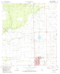
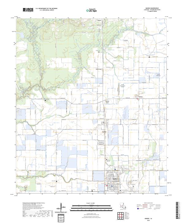
Mamou stands as the primary hub in this Evangeline Parish landscape, where the rectilinear grid of Cajun country roads meets the winding courses of Grand Louis Bayou and the East Fork Bayou Nezpique. The map documents a deeply rooted agricultural and residential pattern, characterized by numerous family-named cemeteries such as Ardoin Cem, Perron Cem, and Ortego Cem. These small burial grounds are scattered among rural settlements like Reddell, Vidrine, and Easton, reflecting the lineage-based settlement history of the Prairie Mamou region.
Find a feature on this map
107 named features on this map. Tap any name to fly to it.
Don’t see what you’re looking for? This feature index may not catch every label — zoom into the map to look around manually.
Map Details
Editions of this 2024 Mamou Map
This is the sole edition of this map. No revisions or reprints were ever made.