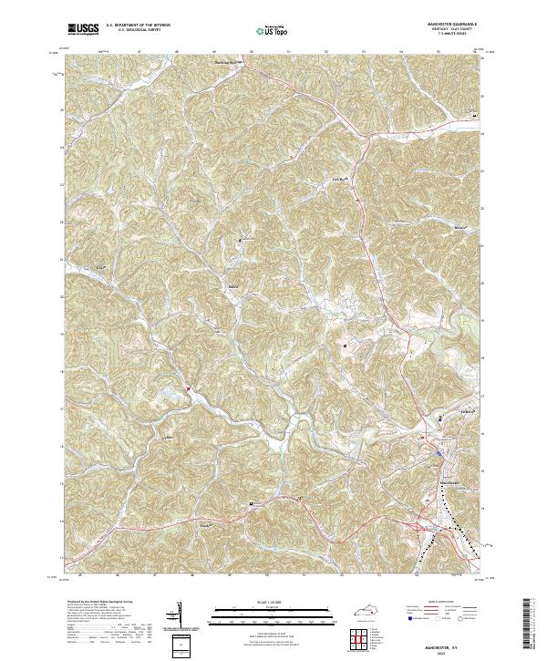
2022 Map of Manchester
USGS Topo · Published 2022About this map
The confluence of Goose Creek and Little Goose Creek anchors the southeast corner of this Clay County landscape, where the county seat of Manchester serves as a modern hub. The terrain is defined by a dense network of winding hollows and branches, including Burning Springs Br and Needmore Br, which dictate the placement of local thoroughfares like State Hwy 638. While the Hal Rogers Pky provides a corridor for rapid travel, the map preserves the traditional locations of smaller settlements such as Burning Springs, Urban, and Hooker. Genealogists will find several family-named landmarks and cemeteries, including the Brown Mission Cem and Sandin Cem, which are tucked away in the drainages of Mire Br and Sandin Br. Rising above the valley floor, Pilot Mtn and Spice Gap highlight the elevation shifts that have historically influenced development in this part of Kentucky.
Find a feature on this map
64 named features on this map. Tap any name to fly to it.
Don’t see what you’re looking for? This feature index may not catch every label — zoom into the map to look around manually.
Map Details
Editions of this 2022 Manchester Map
This is the sole edition of this map. No revisions or reprints were ever made.
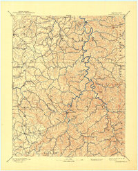
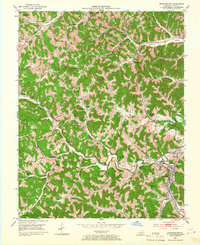
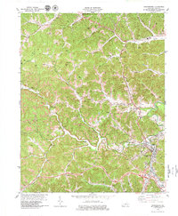
Historical Maps of Urban Through Time
4 maps found