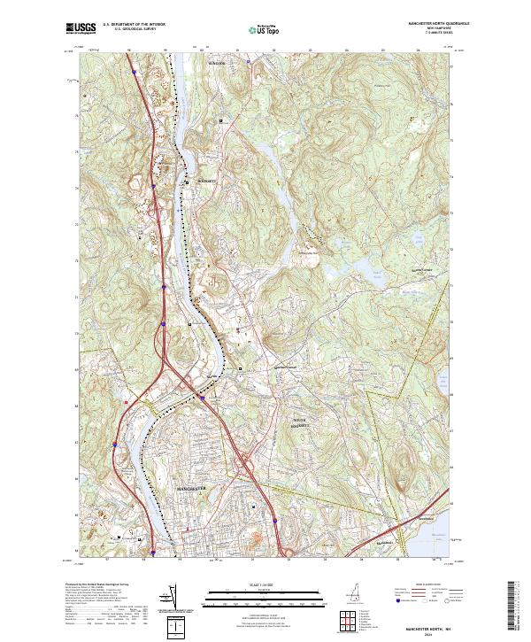
2024 Map of Manchester North
USGS Topo · Published 2024About this map
The Merrimack River carves a central path through this landscape, serving as a historic corridor for development between Hooksett and the northern reaches of Manchester. The terrain is punctuated by distinctive rises such as The Pinnacle and Rattlesnake Hill, while the eastern portion of the sheet is dominated by the sprawling waters of Massabesic Lake and Tower Hill Pond. The map reveals a dense network of suburban growth and institutional presence, notably Southern New Hampshire University and Manchester Community College.
Find a feature on this map
53 named features on this map. Tap any name to fly to it.
Don’t see what you’re looking for? This feature index may not catch every label — zoom into the map to look around manually.
Map Details
Editions of this 2024 Manchester North Map
This is the sole edition of this map. No revisions or reprints were ever made.
Other maps of this area

1905 · Manchester
USGS Topo · 1:62,500

1906 · Milford
USGS Topo · 1:62,500

1921 · Suncook
USGS Topo · 1:62,500

1927 · Concord
USGS Topo · 1:62,500

1941 · Manchester
USGS Topo · 1:62,500

1943 · Lowell
USGS Topo · 1:125,000

1943 · Fitchburg
USGS Topo · 1:125,000

1944 · Suncook
USGS Topo · 1:62,500

1948 · Boston
USGS Topo · 1:250,000

1949 · Portland
USGS Topo · 1:250,000