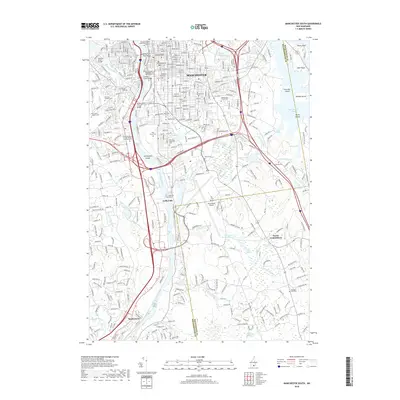
2018 Map of Manchester South
USGS Topo · Published 2018About this map
The Merrimack River flows through the heart of southern Manchester, defining the industrial and urban orientation of this New Hampshire landscape. Along its banks, the map captures the transition from the dense city grid to the aviation hub of Manchester Airport. Historical patterns of settlement are preserved in the numerous burial grounds documented here, including the expansive Pine Grove Cem and the smaller Goffs Falls Cem near the river. Eastward, the terrain shifts into a complex of wetlands and reservoirs, where Little Cohas Brook Reservoir and Massabesic Lake provided essential water infrastructure. The survey also traces the southern extension of Manchester's educational institutions, such as the Univ of New Hampshire at Manchester, alongside the suburban growth reaching toward North Londonderry and the riverside community of Reeds Ferry.
Find a feature on this map
58 named features on this map. Tap any name to fly to it.
Don’t see what you’re looking for? This feature index may not catch every label — zoom into the map to look around manually.
Map Details
Editions of this 2018 Manchester South Map
This is the sole edition of this map. No revisions or reprints were ever made.
Other maps of this area

1905 · Manchester
USGS Topo · 1:62,500

1906 · Milford
USGS Topo · 1:62,500

1921 · Suncook
USGS Topo · 1:62,500

1927 · Concord
USGS Topo · 1:62,500

1941 · Manchester
USGS Topo · 1:62,500

1943 · Lowell
USGS Topo · 1:125,000

1943 · Fitchburg
USGS Topo · 1:125,000

1944 · Suncook
USGS Topo · 1:62,500

1948 · Boston
USGS Topo · 1:250,000

1949 · Portland
USGS Topo · 1:250,000