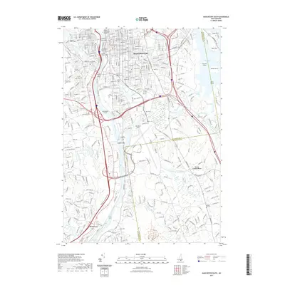
2021 Map of Manchester South
USGS Topo · Published 2021About this map
The Merrimack River serves as the central artery for this industrial corridor, winding past the urban center of Manchester and the southern settlement of Reeds Ferry. This 2021 survey illustrates the complex modern landscape where aviation and heavy transport intersect with early 19th-century history. The Manchester Airport and the sprawling highway network dominate the central terrain, yet numerous legacy sites remain visible. Genealogists can locate several family and denominational burial grounds, such as Goffs Falls Cem, Valley Cem, and Saint Augustine Cem. The transition from rail to recreation is evidenced by the Rockingham Recreational Rail Trl on the eastern side of the city. Water features like Massabesic Lake and Crystal Lake punctuate the landscape, while institutions like the University of New Hampshire and the New Hampshire Institute of Art anchor the downtown district.
Find a feature on this map
53 named features on this map. Tap any name to fly to it.
Don’t see what you’re looking for? This feature index may not catch every label — zoom into the map to look around manually.
Map Details
Editions of this 2021 Manchester South Map
This is the sole edition of this map. No revisions or reprints were ever made.
Other maps of this area

1905 · Manchester
USGS Topo · 1:62,500

1906 · Milford
USGS Topo · 1:62,500

1921 · Suncook
USGS Topo · 1:62,500

1927 · Concord
USGS Topo · 1:62,500

1941 · Manchester
USGS Topo · 1:62,500

1943 · Lowell
USGS Topo · 1:125,000

1943 · Fitchburg
USGS Topo · 1:125,000

1944 · Suncook
USGS Topo · 1:62,500

1948 · Boston
USGS Topo · 1:250,000

1949 · Portland
USGS Topo · 1:250,000