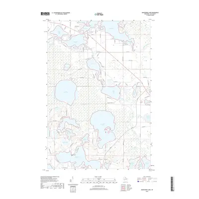
2018 Map of Manitowish Lake
USGS Topo · Published 2018About this map
Powell Marsh dominates the central-western landscape of this Vilas County region, providing a vast natural break between the dense clusters of glacial lakes. To the north, the waters of Manitowish Lake, Spider Lake, and Island Lake form a connected aquatic network, while the Trout River serves as a primary artery winding through the wetlands toward Wild Rice Lake. This area of the Lac du Flambeau reservation exhibits a distinct pattern of seasonal and residential development, with numerous named access points like Boat Landing Rd and Catfish Point on White Sand Lake. Local geography is further defined by smaller basins such as Ike Walton Lake, Big Crooked Lake, and the trio of West Ellerson Lake, Middle Ellerson Lake, and East Ellerson Lake in the southeast. The survey details a complex system of local connectors, including Ave of Birches and Cranberry Blvd, reflecting the area's transition into a modern recreation and conservation landscape.
Find a feature on this map
89 named features on this map. Tap any name to fly to it.
Don’t see what you’re looking for? This feature index may not catch every label — zoom into the map to look around manually.
Map Details
Editions of this 2018 Manitowish Lake Map
This is the sole edition of this map. No revisions or reprints were ever made.
Other maps of this area

1938 · Minocqua
USGS Topo · 1:48,000

1938 · Lac Du Flambeau
USGS Topo · 1:48,000

1939 · Trout Lake
USGS Topo · 1:48,000

1939 · Lac Du Flambeau
USGS Topo · 1:48,000

1939 · Winchester
USGS Topo · 1:48,000

1946 · Winchester
USGS Topo · 1:48,000

1946 · Minocqua
USGS Topo · 1:48,000

1946 · Lac Du Flambeau
USGS Topo · 1:48,000

1946 · Trout Lake
USGS Topo · 1:48,000

1949 · Trout Lake
USGS Topo · 1:48,000