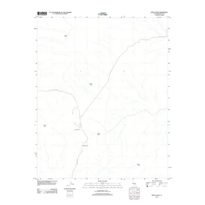
2012 Map of Manly Peak
USGS Topo · Published 2012About this map
Death Valley National Park encompasses this high-desert landscape in the southern Panamint Range, where steep elevations and isolated springs define the geography. The map documents a primitive transportation network centered on Coyote Canyon Rd and Butte Valley Rd, which provide access to the high backcountry. Significant landmarks like Manly Peak and Needle Peak anchor the southern and western portions of the quadrangle, while Striped Butte stands as a prominent geological feature within the central Butte Valley. Evidence of habitation and survival in this arid environment is limited to specific sites such as Russell Camp and Greater View Spring. Near the center of the sheet, the terrain rises to Mengel Pass, a critical point for travelers moving between the canyons. This 2012 survey illustrates the modern boundaries and preserved nature of this portion of Inyo County.
Find a feature on this map
11 named features on this map. Tap any name to fly to it.
Don’t see what you’re looking for? This feature index may not catch every label — zoom into the map to look around manually.
Map Details
Editions of this 2012 Manly Peak Map
This is the sole edition of this map. No revisions or reprints were ever made.
Other maps of this area

1908 · Furnace Creek
USGS Topo · 1:250,000

1908 · Ballarat
USGS Topo · 1:250,000

1910 · Furnace Creek
USGS Topo · 1:250,000

1913 · Ballarat
USGS Topo · 1:250,000

1915 · Searles Lake
USGS Topo · 1:250,000

1933 · Avawatz Mountains
USGS Topo · 1:250,000

1947 · Trona
USGS Topo · 1:250,000

1948 · Trona
USGS Topo · 1:250,000

1948 · Death Valley
USGS Topo · 1:250,000

1950 · Manly Peak
USGS Topo · 1:62,500