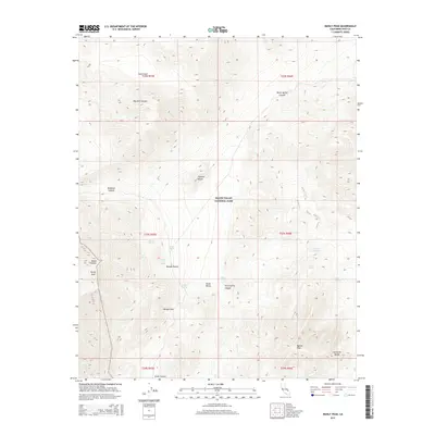
2015 Map of Manly Peak
USGS Topo · Published 2015About this map
Death Valley National Park encompasses this high-elevation desert landscape, where the southern reaches of the Panamint Range meet the northern Mojave Desert. The topography is defined by significant landmarks such as Manly Peak and the distinctive Striped Butte, which rises within Butte Valley. This area is marked by a vital network of water sources in an otherwise arid environment, including Anvil Spring, Willow Spring, and Jubilee Spring. These springs historically served as critical waypoints for travelers and prospectors navigating the difficult terrain of the southern Panamints. The map illustrates the natural corridors used for trans-mountain passage, most notably at Mengel Pass and through the deep cuts of Goler Canyon and Redlands Canyon. This 2015 survey provides a modern record of these remote physical features, preserving the names of canyons and peaks that have long guided exploration in Inyo County.
Find a feature on this map
30 named features on this map. Tap any name to fly to it.
Don’t see what you’re looking for? This feature index may not catch every label — zoom into the map to look around manually.
Map Details
Editions of this 2015 Manly Peak Map
This is the sole edition of this map. No revisions or reprints were ever made.
Other maps of this area

1908 · Furnace Creek
USGS Topo · 1:250,000

1908 · Ballarat
USGS Topo · 1:250,000

1910 · Furnace Creek
USGS Topo · 1:250,000

1913 · Ballarat
USGS Topo · 1:250,000

1915 · Searles Lake
USGS Topo · 1:250,000

1933 · Avawatz Mountains
USGS Topo · 1:250,000

1947 · Trona
USGS Topo · 1:250,000

1948 · Trona
USGS Topo · 1:250,000

1948 · Death Valley
USGS Topo · 1:250,000

1950 · Manly Peak
USGS Topo · 1:62,500