2023 Map of Manson
USGS Topo · Published 2023About this map
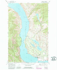
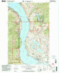
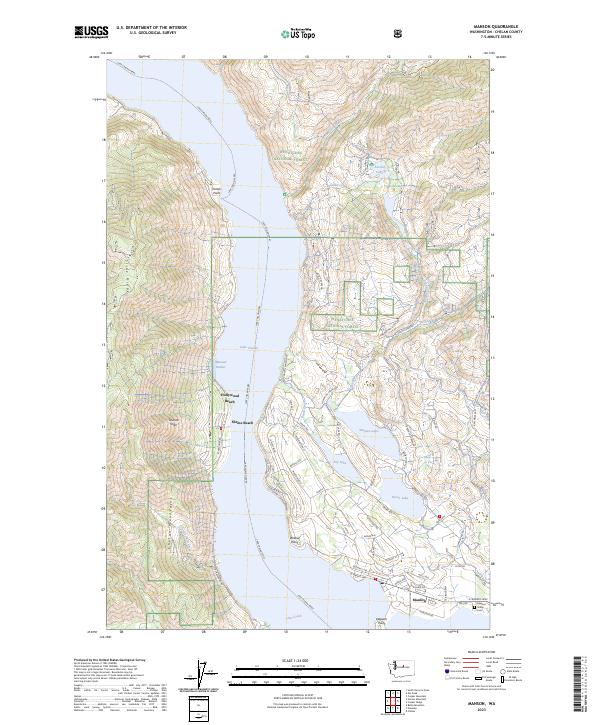
Lake Chelan dominates this landscape, its deep waters serving as a primary transit corridor where the Lake Chelan Ferry maintains a critical link between the steep slopes of the Chelan Mountains and the developed eastern shore. In the southern reach, the community of Manson is surrounded by a complex system of smaller water bodies including Wapato Lake, Roses Lake, and Dry Lake, which support the local agriculture and residential pockets. Cultural landmarks like the Manson Indian Cem and various beach settlements such as Hollywood Beach, Shrine Beach, and Willow Point indicate a long history of both Indigenous presence and later recreational development. The terrain transitions sharply from the forested heights of the Wenatchee National Forest and Slide Ridge down to the lakeshore, where a network of local roads like Manson Blvd and Wapato Lake Rd navigate the basin's contours.
Find a feature on this map
66 named features on this map. Tap any name to fly to it.
Don’t see what you’re looking for? This feature index may not catch every label — zoom into the map to look around manually.
Map Details
Editions of this 2023 Manson Map
This is the sole edition of this map. No revisions or reprints were ever made.