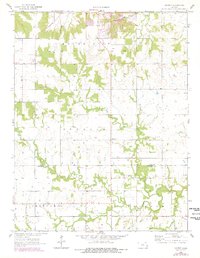
1958 Map of Mantey
USGS Topo · Published 1978About this map
Mantey sits as a central settlement in this late-1950s landscape, positioned near the boundary of Linn and Bourbon Counties. The terrain is defined by the winding course of the Little Osage River to the south and several vital drainage systems including Elk Creek and Lost Creek. This survey captures a rural Kansas economy in transition, where traditional agriculture meets active resource extraction. Numerous Strip Mines, a Gravel Pit, and scattered Oil Wells are prominent across the townships of Stanton and Freedom, signaling the area's industrial importance during this era. Local genealogy is well-supported by the inclusion of several burial grounds, such as Shaw Cem, Curry Cem, and Elk Creek Cem, which provide fixed points of reference for families rooted in the region before the 1970s revisions.
Find a feature on this map
22 named features on this map. Tap any name to fly to it.
Don’t see what you’re looking for? This feature index may not catch every label — zoom into the map to look around manually.
Map Details
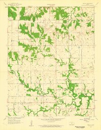
Editions of this 1958 Mantey Map
2 editions found
Other maps of this area

1884 · Fort Scott
USGS Topo · 1:125,000

1886 · Fort Scott
USGS Topo · 1:125,000

1887 · Mound City
USGS Topo · 1:125,000

1893 · Fort Scott
USGS Topo · 1:125,000

1893 · Mound City
USGS Topo · 1:125,000

1947 · Lawrence
USGS Topo · 1:250,000

1947 · Joplin
USGS Topo · 1:250,000

1949 · Joplin
USGS Topo · 1:250,000

1950 · Lawrence
USGS Topo · 1:250,000

1954 · Joplin
USGS Topo · 1:250,000