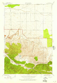
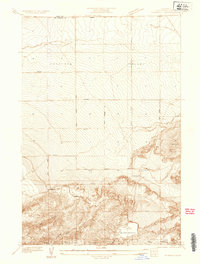
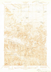
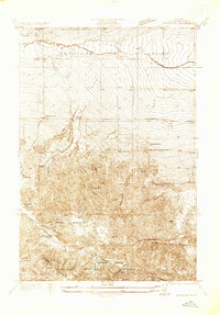
1950 Map of Manzana
USGS Topo · Published 1957About this map
Antelope Valley and the northern slopes of Liebre Mountain are captured here during a period of transition in high-desert ranching and infrastructure. The map prominently tracks the Aqueduct as it cuts across the arid landscape, while the southern portion is dominated by the geological scar of the San Andreas Rift. This fault line creates a distinctive corridor of canyons, including Pine Canyon and Oakgrove Canyon, where early 20th-century life centered around small hubs like the Pine Store and the Pine Canyon Sch.
Find a feature on this map
49 named features on this map. Tap any name to fly to it.
Don’t see what you’re looking for? This feature index may not catch every label — zoom into the map to look around manually.
Map Details
Editions of this 1950 Manzana Map
This is the sole edition of this map. No revisions or reprints were ever made.
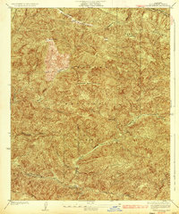
Other maps of this area

1903 · Tejon
USGS Topo · 1:125,000

1915 · Elizabeth Lake
USGS Topo · 1:125,000

1917 · Elizabeth Lake
USGS Topo · 1:125,000
1931 · Warm Spring
USGS Topo · 1:24,000
1931 · Redrock Mtn
USGS Topo · 1:24,000
1932 · Hughes Lake
USGS Topo · 1:24,000
1932 · Fairmont
USGS Topo · 1:24,000
1932 · Neenach
USGS Topo · 1:24,000
1933 · Manzana
USGS Topo · 1:24,000
1936 · Warm Spring
USGS Topo · 1:24,000