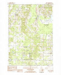
1983 Map of Maple City
USGS Topo · Published 1984About this map
Maple City and Cedar anchor this pocket of Leelanau County, where the landscape transitions from the dense timber of the Pere Marquette State Forest to the small-scale farming and crossroads communities of Kasson and Solon. The map reveals a high concentration of small cemeteries that trace the pioneer genealogy of the region, including Nash-Pettengill Cem and Sullivan Cem in the north, and Linwood Cem near the southern border.
Find a feature on this map
42 named features on this map. Tap any name to fly to it.
Don’t see what you’re looking for? This feature index may not catch every label — zoom into the map to look around manually.
Map Details
Editions of this 1983 Maple City Map
2 editions found
Other maps of this area

1954 · Traverse City
USGS Topo · 1:250,000

1956 · Kingsley
USGS Topo · 1:62,500

1956 · Thompsonville
USGS Topo · 1:62,500

1957 · Traverse City
USGS Topo · 1:62,500

1957 · Maple City
USGS Topo · 1:62,500

1958 · Traverse City
USGS Topo · 1:250,000

1976 · Thompsonville NE
USGS Topo · 1:24,000

1976 · Thompsonville NW
USGS Topo · 1:24,000
1983 · Burdickville
USGS Topo · 1:24,000

1983 · Maple City
USGS Topo · 1:24,000