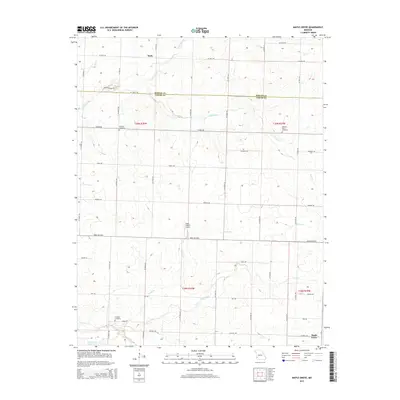
2015 Map of Maple Grove
USGS Topo · Published 2015About this map
Malty sits near the northern boundary of this Barton and Jasper County borderlands map, illustrating the rural character of the Missouri prairie in the early 21st century. The landscape is defined by a dendritic network of small waterways, including Coon Creek, Deer Creek, and the Dry Fork, which carve subtle drainage patterns across the agricultural terrain. The map documents the persistent layout of section-line roads and local thoroughfares like Thorn Rd and Base Line Blvd, which have historically organized the region's farms and small-scale developments.
Find a feature on this map
52 named features on this map. Tap any name to fly to it.
Don’t see what you’re looking for? This feature index may not catch every label — zoom into the map to look around manually.
Map Details
Editions of this 2015 Maple Grove Map
This is the sole edition of this map. No revisions or reprints were ever made.
Other maps of this area

1886 · Carthage
USGS Topo · 1:125,000

1894 · Carthage
USGS Topo · 1:125,000

1921 · Sarcoxie
USGS Topo · 1:62,500

1947 · Joplin
USGS Topo · 1:250,000

1949 · Joplin
USGS Topo · 1:250,000

1954 · Joplin
USGS Topo · 1:250,000

1958 · Joplin
USGS Topo · 1:250,000

1959 · Joplin
USGS Topo · 1:250,000
1962 · Kenoma
USGS Topo · 1:24,000
1962 · Jasper
USGS Topo · 1:24,000