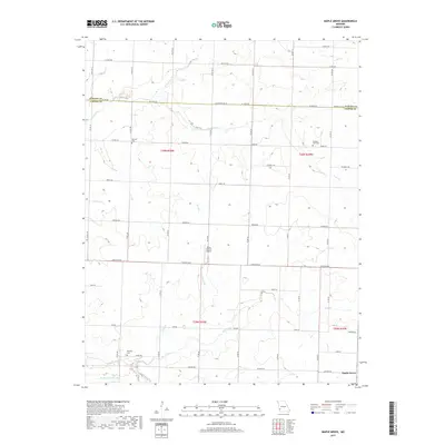
2017 Map of Maple Grove
USGS Topo · Published 2017About this map
Maple Grove sits at the intersection of a vast network of section roads along the border of Barton and Jasper Counties. This landscape is defined by its agricultural character and the complex drainage of the Ozark Plateau foothills, where numerous small waterways like Coon Creek, Deer Creek, and Opossum Cr carve through the terrain. The map reveals a deeply rooted rural community, documented through several local burial grounds including Mitchell Cem, Pleasant View Cem, and Hackney Cem. Transportation in the area relies on a grid of county roads and state routes such as State Hwy T and State Hwy JJ, supporting the movement of goods and people between isolated farmsteads. The presence of the Stony Branch Airport and Maple Lane Farms Lake provides a look into the specialized land use and private infrastructure common in this part of Missouri during the early twenty-first century.
Find a feature on this map
55 named features on this map. Tap any name to fly to it.
Don’t see what you’re looking for? This feature index may not catch every label — zoom into the map to look around manually.
Map Details
Editions of this 2017 Maple Grove Map
This is the sole edition of this map. No revisions or reprints were ever made.
Other maps of this area

1886 · Carthage
USGS Topo · 1:125,000

1894 · Carthage
USGS Topo · 1:125,000

1921 · Sarcoxie
USGS Topo · 1:62,500

1947 · Joplin
USGS Topo · 1:250,000

1949 · Joplin
USGS Topo · 1:250,000

1954 · Joplin
USGS Topo · 1:250,000

1958 · Joplin
USGS Topo · 1:250,000

1959 · Joplin
USGS Topo · 1:250,000
1962 · Kenoma
USGS Topo · 1:24,000
1962 · Jasper
USGS Topo · 1:24,000