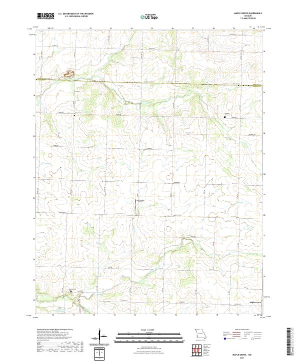
2021 Map of Maple Grove
USGS Topo · Published 2021About this map
The settlement of Maple Grove sits at the southeastern corner of this Jasper County landscape, anchoring a rural region defined by its creek-carved topography and agricultural grid. Waterways like Coon Creek, Deer Creek, and the Dry Fork branch out across the terrain, creating a network of drainage that has historically dictated the placement of farms and small local airfields like the Stony Branch Airport. The map provides a clear look at local genealogy sites, documenting the locations of Mitchell Cem, Pleasant View Cem, and Hackney Cem.
Find a feature on this map
49 named features on this map. Tap any name to fly to it.
Don’t see what you’re looking for? This feature index may not catch every label — zoom into the map to look around manually.
Map Details
Editions of this 2021 Maple Grove Map
This is the sole edition of this map. No revisions or reprints were ever made.
Other maps of this area

1886 · Carthage
USGS Topo · 1:125,000

1894 · Carthage
USGS Topo · 1:125,000

1921 · Sarcoxie
USGS Topo · 1:62,500

1947 · Joplin
USGS Topo · 1:250,000

1949 · Joplin
USGS Topo · 1:250,000

1954 · Joplin
USGS Topo · 1:250,000

1958 · Joplin
USGS Topo · 1:250,000

1959 · Joplin
USGS Topo · 1:250,000
1962 · Kenoma
USGS Topo · 1:24,000
1962 · Jasper
USGS Topo · 1:24,000