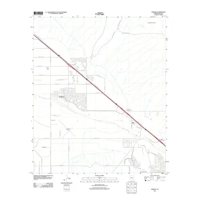
2011 Map of Marana
USGS Topo · Published 2011About this map
The Santa Cruz River corridor serves as the primary axis for development and transit in this Pima County landscape, where the agricultural legacy of Marana meets modern transportation infrastructure. By the early 21st century, the path of the N Casa Grande Hwy dictates the region's growth, marked by major junctions such as the Marana Interchange and the Tangerine Interchange. While the residential street grids of Marana and the settlement at Rillito occupy the valley floor, the terrain rises sharply to the northeast into the Tortolita Mountains and narrows at Rattlesnake Pass in the south.
Find a feature on this map
46 named features on this map. Tap any name to fly to it.
Don’t see what you’re looking for? This feature index may not catch every label — zoom into the map to look around manually.
Map Details
Editions of this 2011 Marana Map
This is the sole edition of this map. No revisions or reprints were ever made.
Other maps of this area
1934 · Tucson Mountains
USGS Topo · 1:125,000
1934 · Newman Peak
USGS Topo · 1:125,000
1947 · Cortaro
USGS Topo · 1:62,500
1947 · Red Rock
USGS Topo · 1:62,500

1956 · Tucson
USGS Topo · 1:250,000
1957 · Cortaro
USGS Topo · 1:62,500
1958 · Tucson
USGS Topo · 1:250,000
1959 · Tucson
USGS Topo · 1:250,000
1959 · Tortolita Mts
USGS Topo · 1:62,500
1959 · Silver Bell Peak
USGS Topo · 1:62,500