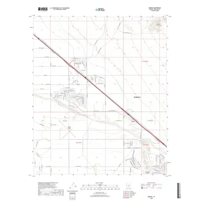
2018 Map of Marana
USGS Topo · Published 2018About this map
The town of Marana serves as the focal point of this corridor northwest of Tucson, where the modern desert landscape is defined by large-scale infrastructure and residential expansion. The massive Central Arizona Project Aqueduct cuts across the northern terrain, bypassing the Tortolita Mountains as it delivers water through the arid Avra Valley. Near the banks of the Santa Cruz River, the settlement of Rillito remains a distinct point along the transportation spine formed by the N Casa Grande Hwy and the Interstate 10 corridor. The presence of the Marana Regional Airport and burgeoning developments like those along Saguaro Peaks Blvd near Rattlesnake Pass illustrate the transformation of formerly agricultural or open desert lands into a modern logistical and residential hub during the early 21st century.
Find a feature on this map
77 named features on this map. Tap any name to fly to it.
Don’t see what you’re looking for? This feature index may not catch every label — zoom into the map to look around manually.
Map Details
Editions of this 2018 Marana Map
This is the sole edition of this map. No revisions or reprints were ever made.
Other maps of this area

1934 · Tucson Mountains
USGS Topo · 1:125,000

1934 · Newman Peak
USGS Topo · 1:125,000

1947 · Cortaro
USGS Topo · 1:62,500

1947 · Red Rock
USGS Topo · 1:62,500

1956 · Tucson
USGS Topo · 1:250,000

1957 · Cortaro
USGS Topo · 1:62,500

1958 · Tucson
USGS Topo · 1:250,000

1959 · Tucson
USGS Topo · 1:250,000

1959 · Tortolita Mts
USGS Topo · 1:62,500
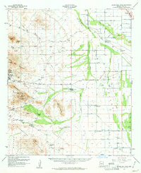
1959 · Silver Bell Peak
USGS Topo · 1:62,500