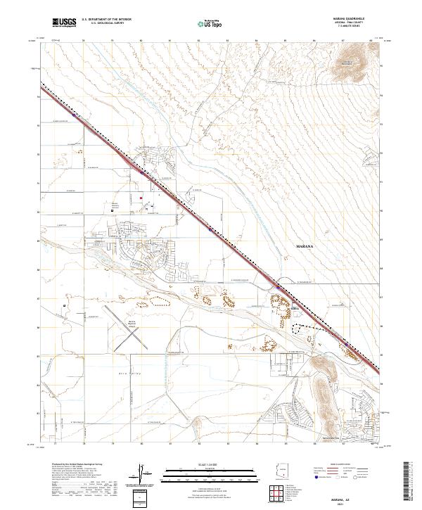
2021 Map of Marana
USGS Topo · Published 2021About this map
The Santa Cruz River valley near Marana reflects a landscape defined by modern infrastructure and high-desert terrain. In this contemporary survey, the Central Arizona Project Aqueduct cuts a long diagonal path across the arid flats of the Avra Valley, paralleling the critical transportation corridor formed by the Union Pacific Railroad and Interstate 10. The northeastern corner of the map is dominated by the foothills of the Tortolita Mountains, while the south features the natural gap at Rattlesnake Pass. This era shows significant suburban development and logistics growth, centered around the Marana Regional Airport and the smaller settlement of Rillito. Local landmarks like the Marana Mortuary and Cem and numerous new residential streets such as W Gladden Farms Dr and W Clark Farms Bl indicate the transition of former agricultural lands into an expanding residential footprint.
Find a feature on this map
88 named features on this map. Tap any name to fly to it.
Don’t see what you’re looking for? This feature index may not catch every label — zoom into the map to look around manually.
Map Details
Editions of this 2021 Marana Map
This is the sole edition of this map. No revisions or reprints were ever made.
Other maps of this area

1934 · Tucson Mountains
USGS Topo · 1:125,000

1934 · Newman Peak
USGS Topo · 1:125,000

1947 · Cortaro
USGS Topo · 1:62,500

1947 · Red Rock
USGS Topo · 1:62,500

1956 · Tucson
USGS Topo · 1:250,000

1957 · Cortaro
USGS Topo · 1:62,500

1958 · Tucson
USGS Topo · 1:250,000

1959 · Tucson
USGS Topo · 1:250,000

1959 · Tortolita Mts
USGS Topo · 1:62,500
1959 · Silver Bell Peak
USGS Topo · 1:62,500