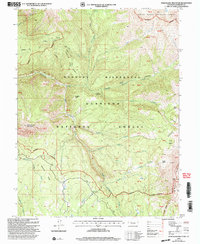
2001 Map of Marcellina Mountain
USGS Topo · Published 2004About this map
Marcellina Mountain and the Ruby Range dominate this high-elevation landscape within the Gunnison National Forest and Ragged Mountain Wilderness. The map reveals a complex system of alpine drainages, including the headwaters of Ruby Anthracite Creek and North Anthracite Creek, which carve deep canyons below Lightning Ridge. A notable human imprint on the land is the Stock Driveway, a historic route for moving livestock through the high country. Evidence of geological exploration is scattered across the terrain, with several Prospect sites and the prominent igneous formation known as The Dyke near Ruby Peak. The topography is characterized by extreme verticality, highlighted by features like the Devils Stairway and the broad alpine bowls of Silver Basin and Gold Basin.
Find a feature on this map
62 named features on this map. Tap any name to fly to it.
Don’t see what you’re looking for? This feature index may not catch every label — zoom into the map to look around manually.
Map Details
Editions of this 2001 Marcellina Mountain Map
This is the sole edition of this map. No revisions or reprints were ever made.
Other maps of this area

1888 · Anthracite
USGS Topo · 1:62,500

1889 · Anthracite
USGS Topo · 1:62,500

1893 · Anthracite
USGS Topo · 1:62,500

1894 · Anthracite
USGS Topo · 1:62,500

1938 · Mt. Gunnison
USGS Topo · 1:48,000

1945 · Mount Gunnison
USGS Topo · 1:62,500

1956 · Montrose
USGS Topo · 1:250,000

1957 · Leadville
USGS Topo · 1:250,000

1959 · Leadville
USGS Topo · 1:250,000

1959 · Montrose
USGS Topo · 1:250,000