Old Maps of Gunnison County, Colorado
Explore 560 old maps of Gunnison County, spanning from 1888 to today. These high-resolution historic maps reveal how streets, neighborhoods, landmarks, and natural features evolved over time — perfect for genealogy, metal detecting, research, and local history exploration.
What you can do with these maps:
- See how Gunnison County changed over time: Compare historical maps to modern-day views to trace roads, homesites, rail lines & more.
- View detailed metadata: Each map includes creators, publishers, year, scale, and archive source.
- Overlay maps with satellite & LiDAR: Visualize the past alongside modern tools to explore terrain & human change.
- Trusted historical sources: Maps sourced from the USGS, Library of Congress, and other archives.
- Access maps your way: View online, download high-res files, or order prints for personal or research use.
Start exploring old maps of Gunnison County to uncover forgotten places, hidden landmarks, and the deep history beneath your feet.
Gunnison County, CO maps
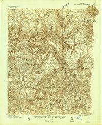
(560)- 1888 Map of Crested Butte
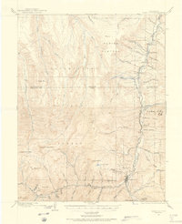
 1888 Crested Butte1888 Print · USGSCrested Butte was a burgeoning rail and coal hub in the late nineteenth century, surrounded by the high peaks of the Gunnison country. You can trace the Denver and Rio Grande Railroad line through the valley or locate the mining camp of Gothic and the namesake Crested Butte peak.2 unique versions available
 - 1888 Map of Anthracite, 1956 Print
 1888 Anthracite1956 Print · USGSThe Gunnison County backcountry comes alive in the late 1880s as mining camps and high-altitude trails reach their peak. Researchers can trace the routes through Daisy Pass to early settlements like Irwin, Ruby, and the remote Mt Carbon P.O.
 - 1889 Map of Crested Butte
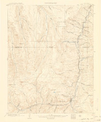
 1889 Crested Butte1889 Print · USGSIn the late nineteenth-century Elk Mountains, the arrival of the Denver and Rio Grande Railroad transformed isolated mountain camps into vital industrial hubs. Researchers can trace the early streets of Crested Butte and Gothic or locate remote landmarks like the Hot Spring and Washington Gulch.
 - 1889 Map of Anthracite
 1889 Anthracite1889 Print · USGSGunnison County was at its silver-mining peak in the 1880s when this survey was conducted. Local historians can trace the early rail terminus at Baldwin, the remote post office at Mt Carbon P.O., and the cluster of mining camps at Irwin and Ruby.
 - 1893 Map of Anthracite
 1893 Anthracite1893 Print · USGSGunnison County was a burgeoning mining frontier in the late nineteenth century, defined by high-altitude camps and coal-rich mesas. Genealogists and historians can trace the early footprints of settlements like Irwin, Ruby, and Pittsburgh or follow the narrow-gauge route of the Denver South Park and Pacific Railroad.9 unique versions available
 - 1893 Map of Crested Butte
 1893 Crested Butte1893 Print · USGSThe high Elk Mountains of the 1890s are mapped here as silver and coal drove the region's development. Trace the early tracks of the Denver and Rio Grande Railroad into Crested Butte or locate the camp at Gothic near the Saw Tooth Range.6 unique versions available
 - 1893 Map of Aspen, 1958 Print
 1893 Aspen1958 Print · USGSSilver mining in the Roaring Fork Valley was in full swing during the late nineteenth century. Genealogists and historians can trace industrial roots at the Molly Gibson Mine, the early streets of Aspen, and the remote settlement of Ashcroft.2 unique versions available
 - 1894 Map of Anthracite
 1894 Anthracite1894 Print · USGSGunnison County is seen here during the height of its late-century mining boom, showing the complex high-country terrain before modern development. Genealogists can locate vanished settlements like Irwin and Ruby or trace the Denver South Park and Pacific Railroad to Baldwin.
 - 1895 Map of Aspen
 1895 Aspen1895 Print · USGSSilver mining and high-altitude rail dominate the Aspen area in the mid-1890s. Genealogists and historians can trace the industrial footprint of the Molly Gibson Mine, locate the vanished streets of Ashcroft, and follow the Denver and Rio Grande R. R.5 unique versions available
 - 1902 Map of Ouray, 1963 Print
 1902 Ouray1963 Print · USGSThe mountain town of Ouray and its surrounding peaks were surveyed at the start of the twentieth century. Genealogists and historians can trace the path of the Denver and Rio Grande R. R. through Bachelor Switch, Portland, and past the waters of Lake Lenore.
 - 1903 Map of Lake City, 1955 Print
 1903 Lake City1955 Print · USGSHinsdale County's mining heart is captured here at the turn of the century as industrial rail lines reached deep into the high country. Genealogists and historians can trace the foundations of Lake City and Capitol City, or locate specific industrial sites like the Hidden Treasure Mill and the Denver and Rio Grande R. R.2 unique versions available
 - 1904 Map of Ouray
 1904 Ouray1904 Print · USGSIn the early 1900s, the mining hub of Ouray was already a critical terminal for the Denver and Rio Grande RR. Historians can trace the industrial corridor from Portland down to Ouray, finding sites like the New York Tunnel and the Hot Springs as they appeared over a century ago.3 unique versions available
 - 1905 Map of Lake City
 1905 Lake City1905 Print · USGSHinsdale County’s high-country mining district is captured here at the start of the twentieth century. Genealogists and historians can trace the rail route of the Rio Grande and Western, explore the streets of Lake City, and locate remote industrial sites like the Hidden Treasure Mill.2 unique versions available
 - 1908 Map of Uncompahgre, 1954 Print
 1908 Uncompahgre1954 Print · USGSThe Gunnison River canyon and high mesas defined life in this corner of Colorado during the early twentieth century. Genealogists and historians can trace the Denver and Rio Grande Railroad line through mountain outposts like Sapinero, Cebolla, and the Gunnison Mine.2 unique versions available
 - 1909 Map of Mount Jackson, 1955 Print
 1909 Mount Jackson1955 Print · USGSPitkin County was a thriving center of high-country mining and railroading during the early 1900s. Genealogists and historians can trace the rail lines of the Colorado Midland Railway and locate vanished sites like Ashcroft and the Little Annie Mine.2 unique versions available
 - 1909 Map of Montrose, 1960 Print
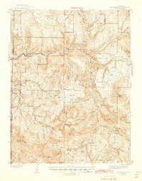
 1909 Montrose1960 Print · USGSThe Uncompahgre Valley and surrounding peaks come into focus during the first decade of the twentieth century. Researchers can trace the Denver and Rio Grande Western RR through Ridgway to Bachelor Switch and the Blaine Mine.
 - 1911 Map of Uncompahgre
 1911 Uncompahgre1911 Print · USGSThe Colorado high country at the start of the twentieth century reveals a landscape of isolated mining camps and vital mountain railways. Genealogists and historians can trace the Denver and Rio Grande RR through Sapinero to remote operations like the Gunnison Mine and Capitol City.2 unique versions available
 - 1911 Map of Montrose
 1911 Montrose1911 Print · USGSThe Uncompahgre River valley and the Denver and Rio Grande RR define the landscape of this region before the First World War. Researchers can trace the early layout of Montrose, the mining influence at Blaine Mine, and the route through Ridgway.3 unique versions available
 - 1911 Map of Mount Jackson
 1911 Mount Jackson1911 Print · USGSThe high Rockies of Pitkin and Eagle Counties are captured here at the peak of the mountain rail era. Researchers can trace the dual tracks of the Colorado Midland RR and the Denver and Rio Grande RR past Aspen and the Little Annie Mine.3 unique versions available
 - 1934 Map of Taylor Park, 1959 Print
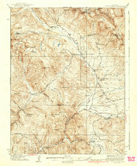
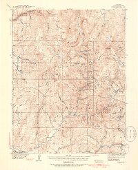
 1934 Taylor Park1959 Print · USGSGunnison County high country in the mid-1930s reveals a landscape of industrial mining and remote ranching. Genealogists and historians can trace family-named sites like Gandy Ranch and Brown Ranch, or locate workings at Pieplant Mine and Star Mine.3 unique versions available
 - 1937 Map of Taylor Park
 1937 Taylor Park1937 Print · USGSThe Sawatch Mountains and Gunnison National Forest are captured here in the 1930s during a peak era of alpine mining and ranching. Researchers can trace historic operations like the Forest Hill Mine and isolated outposts such as Dorchester or Bright Ranch.3 unique versions available
 - 1938 Map of Mt. Gunnison
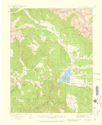
 1938 Mt. Gunnison1938 Print · USGSGunnison County is shown here in the late 1930s, a period defined by high-altitude ranching and the early development of the North Fork valley. Genealogists and historians can trace the locations of old working camps and ranch sites like Davenport Ranch, Berdine, and Hammond Cow Camp.5 unique versions available
 - 1940 Map of Garfield, 1954 Print
 1940 Garfield1954 Print · USGSThe high Sawatch Range is seen here at the peak of its industrial mining era, straddling the Continental Divide. Genealogists and historians can trace defunct mountain rail routes and remote settlements like St Elmo, Hancock, and the historic Old Alpine Tunnel.6 unique versions available
 - 1941 Map of Pitkin, 1954 Print
 1941 Pitkin1954 Print · USGSGunnison County peaks and high-country mining camps are documented here in the mid-twentieth century. Genealogists and historians can trace families and claims through the Pitkin and Ohio City settlements or locate sites like the Sparta Sch and Gold Links Mine.5 unique versions available
 - 1945 Map of Mount Gunnison
 1945 Mount Gunnison1945 Print · USGSGunnison and Delta counties are shown in the mid-1940s during a time when high-country cabins and stock trails defined the landscape. Researchers can trace the Munsey Ruby Stock Driveway or locate remote sites like Bardine and Snowshoe Cabin.2 unique versions available
Showing maps 1-25 of 560
Top cities of Gunnison County
- Gunnison historical maps
- Crested Butte historical maps
- Mount Crested Butte historical maps
- Marble historical maps
- Pitkin historical maps
Frequently asked questions
- What are the different types of historical maps available for Gunnison County?
- What is the oldest map of Gunnison County?
- Where can I purchase historical maps of Gunnison County for my home or office?
- Where can I download high-res historical maps of Gunnison County?
- Are there historical topographic maps available for Gunnison County?
- Is there historical aerial imagery available for Gunnison County?
- Where are historical maps of Gunnison County sourced from?