2020s Maps of Gunnison County, Colorado
Explore 77 historic maps of Gunnison County from the 2020s. These maps offer a rare glimpse into what life looked like during the 2020s — showing old roads, neighborhoods, homes, and landmarks that have changed or disappeared over time.
Whether you're researching your family's past, planning a metal detecting trip, or studying how Gunnison County's landscape evolved across the 2020s, these high-resolution maps are a powerful tool for exploring the history of this region.
- Focus on a specific era: All maps on this page are from the 2020s, giving you a focused view of this time period.
- See what’s changed: Compare century-old streets, trails, and buildings to today's modern landscape using overlays and satellite layers.
- Research with precision: Use these maps for genealogy, historical research, land use analysis, or educational projects.
- View, download, or print: Maps are fully viewable online in high resolution, and can be downloaded or printed for your own records.
Start exploring Gunnison County's history through authentic maps from the 2020s. This is your window into the past.
Gunnison County, CO maps
(77)- 2022 Map of Doyleville, 2022 Print
 2022 Doyleville2022 Print · USGSHigh-altitude ranching and water management define this Colorado landscape during the early 2020s. Genealogists can locate Doyleville Cem Number 1, while researchers trace the Arch Irrigation Ditch near Tomichi Dome.
 - 2022 Map of Parlin, 2022 Print
 2022 Parlin2022 Print · USGSThe Gunnison County ranching landscape around the turn of the 21st century comes to life at the junction of Quartz Cr and Tomichi Creek. Trace the movement of water and history along the Corbitt Ditch, the mountain settlement of Parlin, and high-altitude landmarks like Indian Head.
 - 2022 Map of Iris, 2022 Print
 2022 Iris2022 Print · USGSHigh-altitude Gunnison and Saguache counties come into focus in this recent survey of the Colorado interior. Researchers can trace the legacy of remote settlements like Iris and Sillsville or locate the Iris Cem tucked among landmarks like Schisto Basin.
 - 2022 Map of Garfield, 2022 Print
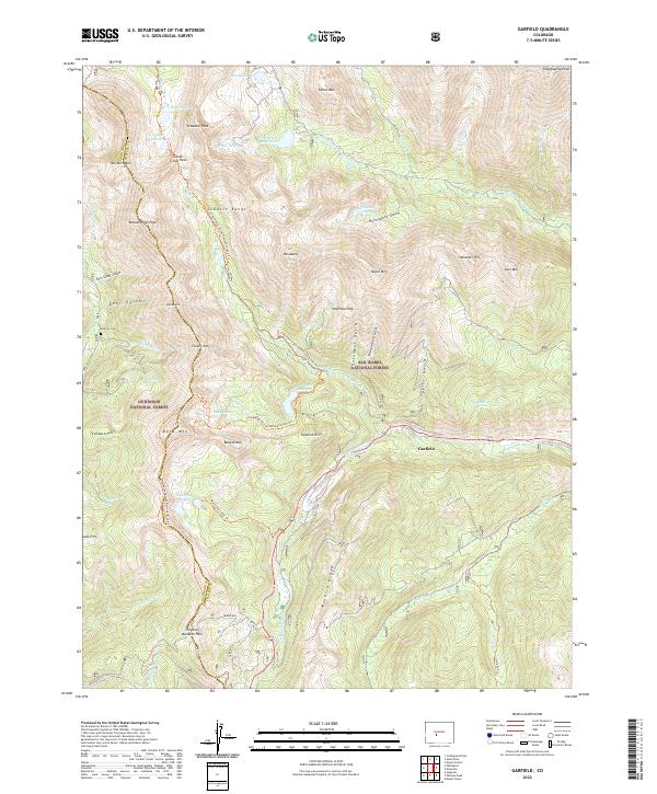 2022 Garfield2022 Print · USGSHigh in the Sawatch Range during the early 2020s, this area centers on the mountain community of Garfield. Trace old routes near Original Monarch Pass and locate the Tomichi Cem amidst the peaks of Mt Aetna and Tabeguache Peak.
 - 2022 Map of Fairview Peak, 2022 Print
 2022 Fairview Peak2022 Print · USGSHigh in the Gunnison National Forest during the early twenty-first century, this alpine landscape serves as a preserve of Colorado's backcountry geography. You can trace established wilderness routes like the Fossil Ridge Trl and Fairview Trl to reach Gunsight Pass or Henry Lake.
 - 2022 Map of Pahlone Peak, 2022 Print
 2022 Pahlone Peak2022 Print · USGSThe high passes of the Sawatch Range are captured here as they appeared in 2022, marking the convergence of three Colorado counties. Trace the historic route of Old Monarch Pass or follow high-altitude corridors like the Colorado Trail and Agate Creek Trail.
 - 2022 Map of Sargents, 2022 Print
 2022 Sargents2022 Print · USGSHigh in the Gunnison National Forest during the early 2020s, this area centers on the mountain settlement of Sargents. Local historians can trace high-altitude routes like Black Sage Pass and the Marshall Pass Snowmobile Trl through the Sawatch Range.
 - 2022 Map of Matchless Mountain, 2022 Print
 2022 Matchless Mountain2022 Print · USGSHigh in the Sawatch Range during the 2020s, this area of the Gunnison National Forest reveals a wilderness of steep gulches and peaks. Trace high-altitude routes like the Doctor Park Trl and Matchless Trl past Matchless Mtn.
 - 2022 Map of Gunnison, 2022 Print
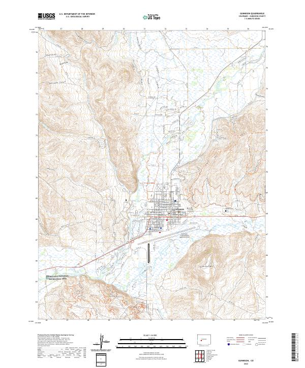 2022 Gunnison2022 Print · USGSGunnison thrives as a mountain crossroads and university center during the early twenty-first century. Researchers can trace the town grid from the Gunnison County Courthouse to the campus of Western Colorado University and the Gunnison-Crested Butte Regional Airport.
 - 2022 Map of Mount Harvard, 2022 Print
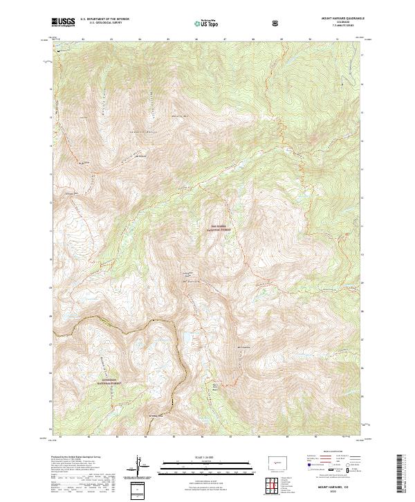 2022 Mount Harvard2022 Print · USGSThe high Sawatch Range peaks of Chaffee County come into focus in this recent survey. Researchers can trace historic access routes like the Colorado Trl or locate the Winfield Cem near the headwaters of Clear Cr.
 - 2022 Map of Whitepine, 2022 Print
 2022 Whitepine2022 Print · USGSThe Sawatch Range near the Gunnison and Chaffee county line was a hive of alpine activity long before modern recreation took hold. Genealogists and researchers can trace the footprint of Whitepine, visit the White Pine Cem, and explore old high-country routes like Tomichi Pass and the Waunita Trl.
 - 2022 Map of Gothic, 2022 Print
 2022 Gothic2022 Print · USGSHigh-altitude settlements and recreation trails define the Elk Mountains in the early twenty-first century. Researchers can trace land use through Gothic, Mount Crested Butte, and the Crested Butte Cem while locating landmarks like Judd Falls.
 - 2022 Map of Flat Top, 2022 Print
 2022 Flat Top2022 Print · USGSGunnison County high-country ranching and forest lands are captured in the early 2020s, showing a landscape defined by water rights and steep terrain. You can trace vital irrigation routes like the Gunnison Highline Canal and Mary Bohm Ditch beneath the heights of Flat Top.
 - 2022 Map of Signal Peak, 2022 Print
 2022 Signal Peak2022 Print · USGSThe high mesas and creek valleys east of Gunnison are captured in the early 2020s, showing a landscape shaped by the Sawatch Range. Trace the network of modern trails around Signal Peak or follow the waters of Tomichi Creek near Flat Top.
 - 2022 Map of Pitkin, 2022 Print
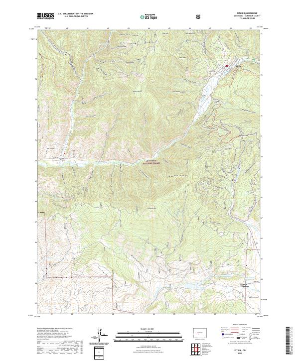 2022 Pitkin2022 Print · USGSGunnison County high country is shown in detail here in the early twenty-first century, spanning the peaks and gulches of the Sawatch Range. Genealogists and hikers can locate Pitkin Cem, trace the waters of Waunita Hot Springs, and explore old mining routes like the Willow Mine Trl.
 - 2022 Map of Pearl Pass, 2022 Print
 2022 Pearl Pass2022 Print · USGSThe high peaks of the Colorado Rockies take center stage in the early twenty-first century, spanning the border of Pitkin and Gunnison counties. Outdoor enthusiasts and historians can trace high-altitude routes like Pearl Pass and explore named summits including Star Peak and Italian Mtn.
 - 2022 Map of Iris NW, 2022 Print
 2022 Iris NW2022 Print · USGSGunnison and Saguache counties meet in this 2022 map of high-country drainages and extensive trail networks. Researchers and outdoorsmen can trace routes through Stubbs Gulch or follow named paths like Skull Pass Trl and Broken Shovel Trl.
 - 2022 Map of Crystal Creek, 2022 Print
 2022 Crystal Creek2022 Print · USGSGunnison County's high-country terrain is captured here in the early twenty-first century, showing the intersection of the Sawatch Range and Fossil Ridge. Outdoor historians and hikers can trace primitive routes like the Van Tuyl Trl, Fossil Ridge Trl, and the road through Taylor Canyon.
 - 2022 Map of Italian Creek, 2022 Print
 2022 Italian Creek2022 Print · USGSIn the high Gunnison National Forest during the early twenty-first century, this alpine landscape serves as a hub for backcountry navigation. Trace historical routes and mountain landmarks like American Flag Mtn, Mysterious Lake, and the Italian Pass Trl.
 - 2022 Map of Powderhorn, 2022 Print
 2022 Powderhorn2022 Print · USGSThe community of Powderhorn and the geothermal Cebolla-Hot Springs are documented here in the high Gunnison country. Genealogists and researchers can trace the drainages of Cebolla Cr and landmarks like Huntsman Mesa or Iron Hill.
 - 2022 Map of Rudolph Hill, 2022 Print
 2022 Rudolph Hill2022 Print · USGSGunnison County ranching and backcountry trails define this high-country landscape near the Hinsdale County line. Genealogists and hikers can trace historic markers like Powderhorn Cem and the routes of the East Fork Trl or Middle Fork Trl.
 - 2022 Map of Sheep Mountain, 2022 Print
 2022 Sheep Mountain2022 Print · USGSThe high alpine terrain of Gunnison and Hinsdale counties is shown here in the early twenty-first century, defined by its complex trail systems and river headwaters. Researchers can trace historic access routes like the Alpine Guard Station Trail and locate landmarks such as Sheep Mountain and Slide Lake.
 - 2022 Map of Mount Guero, 2022 Print
 2022 Mount Guero2022 Print · USGSGunnison National Forest is captured here in the early twenty-first century, showing a high-country landscape of peaks and water-rights infrastructure. Researchers can trace the paths of the Virginia Ditch or locate landmarks like Castle Rock and the Bald Mountain Reservoir.
 - 2022 Map of Anthracite Range, 2022 Print
 2022 Anthracite Range2022 Print · USGSThe high country of the Gunnison National Forest is captured here in the early twenty-first century. Hikers and researchers can trace the historic paths over Beckwith Pass, visit the waters of Lost Lake Slough, or study the steep terrain of the Anthracite Range.
 - 2022 Map of Buckhorn Lakes, 2022 Print
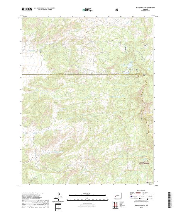 2022 Buckhorn Lakes2022 Print · USGSHigh alpine lakes and jagged ridgelines define this section of the Uncompahgre National Forest as it appeared in recent years. Trace the rugged path of the Cimarron Ridge past landmarks like Castle Rock and the remote Onion Lakes.
Showing maps 1-25 of 77
Top cities of Gunnison County
- Gunnison historical maps
- Crested Butte historical maps
- Mount Crested Butte historical maps
- Marble historical maps
- Pitkin historical maps
Frequently asked questions
- What are the different types of historical maps available for Gunnison County?
- What is the oldest map of Gunnison County?
- Where can I purchase historical maps of Gunnison County for my home or office?
- Where can I download high-res historical maps of Gunnison County?
- Are there historical topographic maps available for Gunnison County?
- Is there historical aerial imagery available for Gunnison County?
- Where are historical maps of Gunnison County sourced from?