1950s Maps of Gunnison County, Colorado
Explore 17 historic maps of Gunnison County from the 1950s. These maps offer a rare glimpse into what life looked like during the 1950s — showing old roads, neighborhoods, homes, and landmarks that have changed or disappeared over time.
Whether you're researching your family's past, planning a metal detecting trip, or studying how Gunnison County's landscape evolved across the 1950s, these high-resolution maps are a powerful tool for exploring the history of this region.
- Focus on a specific era: All maps on this page are from the 1950s, giving you a focused view of this time period.
- See what’s changed: Compare century-old streets, trails, and buildings to today's modern landscape using overlays and satellite layers.
- Research with precision: Use these maps for genealogy, historical research, land use analysis, or educational projects.
- View, download, or print: Maps are fully viewable online in high resolution, and can be downloaded or printed for your own records.
Start exploring Gunnison County's history through authentic maps from the 1950s. This is your window into the past.
Gunnison County, CO maps
(17)- 1954 Map of Iris NW, 1955 Print
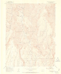
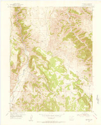
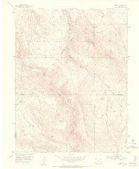 1954 Iris NW1955 Print · USGSThe high-country border of Gunnison and Saguache counties is captured here in the mid-fifties, showing a landscape defined by seasonal creeks and high-altitude trails. Researchers can trace the path of South Beaver Creek or locate the remote Landing Field (Emergency) and the New Mexico Principal Meridian.7 unique versions available
 - 1954 Map of Iola, 1955 Print
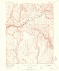
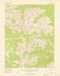
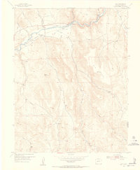 1954 Iola1955 Print · USGSThe Gunnison River valley in the mid-1950s remains a landscape of ranching outposts and historic river crossings. Genealogists and researchers can trace the old railroad grade through Iola and Hierro, or locate family sites like the Shaw Ranch and Kezar.8 unique versions available
 - 1954 Map of Mc Intosh Mountain, 1955 Print
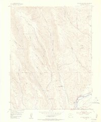 1954 Mc Intosh Mountain1955 Print · USGSGunnison County ranching and river life are preserved here at the dawn of the 1950s. Genealogists and historians can locate family holdings like Harris Hereford Ranch and early vacation spots including Neversink Resort along the Gunnison River.8 unique versions available
 - 1954 Map of West Elk Peak SW, 1955 Print
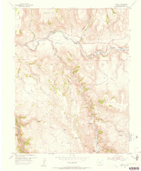
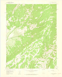
 1954 West Elk Peak SW1955 Print · USGSGunnison County is captured here in the mid-1950s, showing a high-country landscape of timbered gulches and rugged mesas. Local history researchers can trace the old Jeep Trail through Deadman Gulch or locate the early mill sites suggested by Slab Mill Gulch.6 unique versions available
 - 1954 Map of Gunnison, 1955 Print
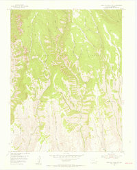
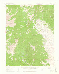
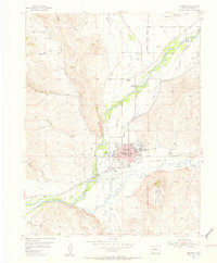 1954 Gunnison1955 Print · USGSMid-century Gunnison thrives at the confluence of the river and Tomichi Creek as a center for education and ranching. Genealogists can trace family landmarks like Thornton Ranch or McCabe Ranch, and locate the Paragon Sch (Aban) and Gunnison Cemetery.5 unique versions available
 - 1954 Map of Little Soap Park, 1955 Print
 1954 Little Soap Park1955 Print · USGSThe Gunnison high country comes into focus in the mid-1950s, showing a landscape defined by forest management and uranium prospecting. Researchers can locate the Uranium Mine, trace the Pack Trail, and find old sites like Soap Creek Campground.6 unique versions available
 - 1954 Map of Cebolla, 1956 Print
 1954 Cebolla1956 Print · USGSGunnison County ranchlands and river valleys are captured here in the mid-1950s, showing a landscape defined by livestock and early tourism. Genealogists and local historians can trace family-named sites like Moncrief Ranch and the Lily Belle Mine.8 unique versions available
 - 1954 Map of Sapinero, 1956 Print
 1954 Sapinero1956 Print · USGSSapinero and the Gunnison River valley are captured in the mid-fifties, shortly before the valley floor was transformed. Genealogists and researchers can trace the original location of Sapinero, the Sapinero Cemetery, and landmarks like Elizonde Ranch or the Sapinero Ranger Sta.10 unique versions available
 - 1954 Map of Gateview, 1956 Print
 1954 Gateview1956 Print · USGSThe Gunnison high country comes alive in the mid-fifties at the junction of the Gunnison River and Lake Fork. Trace the historic Old Railroad Grade past Gateview and locate the mountain-side Dubois Mine (inactive).6 unique versions available
 - 1955 Map of Mount Harvard, 1958 Print
 1955 Mount Harvard1958 Print · USGSThe high peaks of the Sawatch Range are captured here in the mid-1950s at the height of their mining and forest service era. Genealogists and historians can trace the remote settlements of Winfield, Vicksburg, and Tincup, or locate the Banker Mine and Magdalene Mine.4 unique versions available
 - 1956 Map of Curecanti Needle, 1957 Print
 1956 Curecanti Needle1957 Print · USGSThe Gunnison River country during the mid-fifties reveals a high-desert landscape of ranching outposts and deep canyons. Researchers can locate the Rimrock Sch (Aband), the namesake Curecanti Needle, and isolated homesites like Knott Ranch.5 unique versions available
 - 1956 Map of Montrose, 1963 Print
 1956 Montrose1963 Print · USGSThe Colorado western slope in the late fifties and early sixties shows a landscape defined by the Denver & Rio Grande Western RR and the Gunnison River. Trace the development of Blue Mesa Reservoir or locate high-country sites like the Bachelor Mine.3 unique versions available
 - 1957 Map of X Lazy F Ranch, 1959 Print
 1957 X Lazy F Ranch1959 Print · USGSThe Colorado high country in the mid-1950s reveals a landscape of isolated ranching and federal forest management. Genealogists and historians can trace the remote X Lazy F Ranch and water features like Allen Pond, Blue Lake, and the complex drainage of Curecanti Creek.6 unique versions available
 - 1957 Map of Leadville, 1978 Print
 1957 Leadville1978 Print · USGSHigh-country mining and rail transport define the central Colorado Rockies during the mid-to-late twentieth century. Researchers can trace the industrial footprints of Gilman and Climax, find small rail stops like Malta, and follow the Denver and Rio Grande Western RR.2 unique versions available
 - 1959 Map of Leadville
 1959 Leadville1959 Print · USGSThe Colorado high country in the late fifties is a landscape of mining history and military training, from the streets of Leadville to the Camp Hale grounds. Genealogists and historians can trace the Denver and Rio Grande Western RR alongside now-deserted sites like Ashcroft and Independence.
 - 1959 Map of Montrose
 1959 Montrose1959 Print · USGSWestern Colorado in the late fifties is defined by the high peaks and river valleys of the Southern Rockies. Genealogists and historians can trace the paths of the Denver & Rio Grande Western RR or locate mountain settlements like Crawford, Lazear, and Doyleville.
 - 1959 Map of Bonanza, 1961 Print
 1959 Bonanza1961 Print · USGSSaguache County's rugged mining corridors are captured here in the late fifties as the regional silver and lead industries matured. Genealogists and historians can trace the foundations of Bonanza, the former townsite at Sedgwick, and numerous working claims like the Rawley Mine.5 unique versions available
End of results
Showing maps 1-17 of 17
Top cities of Gunnison County
- Gunnison historical maps
- Crested Butte historical maps
- Mount Crested Butte historical maps
- Marble historical maps
- Pitkin historical maps
Frequently asked questions
- What are the different types of historical maps available for Gunnison County?
- What is the oldest map of Gunnison County?
- Where can I purchase historical maps of Gunnison County for my home or office?
- Where can I download high-res historical maps of Gunnison County?
- Are there historical topographic maps available for Gunnison County?
- Is there historical aerial imagery available for Gunnison County?
- Where are historical maps of Gunnison County sourced from?