1990s Maps of Gunnison County, Colorado
Explore 10 historic maps of Gunnison County from the 1990s. These maps offer a rare glimpse into what life looked like during the 1990s — showing old roads, neighborhoods, homes, and landmarks that have changed or disappeared over time.
Whether you're researching your family's past, planning a metal detecting trip, or studying how Gunnison County's landscape evolved across the 1990s, these high-resolution maps are a powerful tool for exploring the history of this region.
- Focus on a specific era: All maps on this page are from the 1990s, giving you a focused view of this time period.
- See what’s changed: Compare century-old streets, trails, and buildings to today's modern landscape using overlays and satellite layers.
- Research with precision: Use these maps for genealogy, historical research, land use analysis, or educational projects.
- View, download, or print: Maps are fully viewable online in high resolution, and can be downloaded or printed for your own records.
Start exploring Gunnison County's history through authentic maps from the 1990s. This is your window into the past.
Gunnison County, CO maps
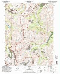
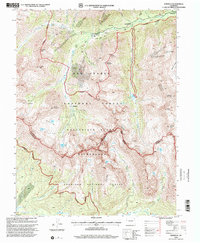
(10)- 1994 Map of Cumberland Pass, 1998 Print
 1994 Cumberland Pass1998 Print · USGSHigh-country mining and railroad history dominate the Continental Divide during the 1990s. Researchers can locate the Old Alpine Tunnel and Alpine Station, or trace early mining claims like the Gold Cup Mine and Bon Ton Mine near Boothill Cemetery.
 - 1994 Map of Independence Pass, 1998 Print
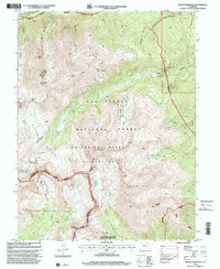
 1994 Independence Pass1998 Print · USGSThe high Sawatch Range is documented in the mid-1990s, where the Continental Divide separates three different national forests. Researchers can locate remote mining sites like the Ruby Mine and historic stopping points such as Independence and Brumley.
 - 1994 Map of Pieplant, 1998 Print
 1994 Pieplant1998 Print · USGSHigh in the Colorado Rockies during the late twentieth century, this survey tracks the intersection of mining history and wilderness conservation. Researchers can locate the Pieplant Mine, the historic Dinner Station, and the remote Pieplant Mill (Site) near the Continental Divide.
 - 1994 Map of Mount Ouray, 1998 Print
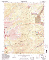 1994 Mount Ouray1998 Print · USGSHigh in the Sawatch Range during the 1990s, this area showcases the vital mountain crossings of Poncha Pass and Marshall Pass. Researchers can locate the Shirley (Site), the Cinderella South Mine, and remote landmarks like Devils Armchair.
 - 1994 Map of Pahlone Peak, 1998 Print
 1994 Pahlone Peak1998 Print · USGSThe high Continental Divide in the mid-1990s serves as a backdrop for active mining and alpine transit. Researchers can trace industrial operations at Pinnacle Mine and Strip Mine, or follow the historic routes over Monarch Pass and the Colorado Trail.
 - 1994 Map of Garfield, 1998 Print
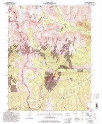 1994 Garfield1998 Print · USGSGarfield and the surrounding peaks of the Continental Divide are captured in the mid-nineties during a period of transition between mining and recreation. Trace the footprint of the Monarch Quarry, locate the Tomichi Cem, and follow the South Arkansas River through the heart of the Rockies.
 - 1994 Map of Tincup, 2001 Print
 1994 Tincup2001 Print · USGSHigh in the Rockies during the mid-nineties, this map captures the transition of the Tincup area from a historic mining district to a wilderness destination. Trace old extraction sites through Dredge Tailings and Mines or follow the Timberline Trail across the Continental Divide.
 - 1994 Map of Mount Yale, 2001 Print
 1994 Mount Yale2001 Print · USGSThe Sawatch Range in the mid-1990s showcases a high-altitude landscape dominated by the fourteen-thousand-foot summit of Mount Yale. Hikers and historians can trace the paths of the Colorado Trail past alpine waters like Cottonwood Lake and historic mining sites such as Holywater Mine.
 - 1994 Map of Winfield, 2001 Print
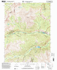
 1994 Winfield2001 Print · USGSThe Sawatch Range highlands in the mid-nineties remained a landscape of silver-mining heritage and rugged peaks along the Continental Divide. Researchers can trace historic sites like the Banker Mine, the settlement of Winfield, and the high-mountain cemetery.
 - 1994 Map of Mount Harvard, 2001 Print
 1994 Mount Harvard2001 Print · USGSThe Sawatch Range peaks near the Chaffee and Gunnison county line are shown here in the 1990s as a haven for mountaineers and historians. Trace the high-altitude mining legacy at the Magdalene Mine or the quiet graves at the Winfield Cemetery.
End of results
Showing maps 1-10 of 10
Top cities of Gunnison County
- Gunnison historical maps
- Crested Butte historical maps
- Mount Crested Butte historical maps
- Marble historical maps
- Pitkin historical maps
Frequently asked questions
- What are the different types of historical maps available for Gunnison County?
- What is the oldest map of Gunnison County?
- Where can I purchase historical maps of Gunnison County for my home or office?
- Where can I download high-res historical maps of Gunnison County?
- Are there historical topographic maps available for Gunnison County?
- Is there historical aerial imagery available for Gunnison County?
- Where are historical maps of Gunnison County sourced from?