2000s (21st Century) Maps of Gunnison County, Colorado
Explore 120 historic maps of Gunnison County from the 2000s (21st Century). These maps offer a rare glimpse into what life looked like during the 2000s — showing old roads, neighborhoods, homes, and landmarks that have changed or disappeared over time.
Whether you're researching your family's past, planning a metal detecting trip, or studying how Gunnison County's landscape evolved across the 2000s, these high-resolution maps are a powerful tool for exploring the history of this region.
- Focus on a specific era: All maps on this page are from the 2000s, giving you a focused view of this time period.
- See what’s changed: Compare century-old streets, trails, and buildings to today's modern landscape using overlays and satellite layers.
- Research with precision: Use these maps for genealogy, historical research, land use analysis, or educational projects.
- View, download, or print: Maps are fully viewable online in high resolution, and can be downloaded or printed for your own records.
Start exploring Gunnison County's history through authentic maps from the 2000s. This is your window into the past.
Gunnison County, CO maps
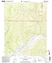
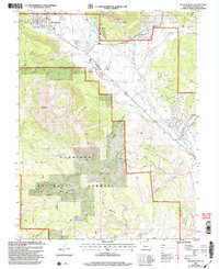
(120)- 2001 Map of Almont, 2004 Print
 2001 Almont2004 Print · USGSCovers Gunnison County, including Almont, United States, and other nearby areas
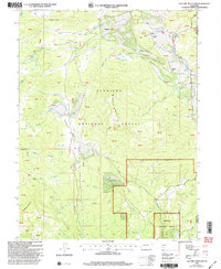
 - 2001 Map of Anthracite Range, 2004 Print
 2001 Anthracite Range2004 Print · USGSCovers Gunnison County, including United States, Colorado, and other nearby areas
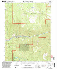
 - 2001 Map of Sargents, 2004 Print
 2001 Sargents2004 Print · USGSCovers Gunnison County, including Sargents, Saguache County, and other nearby areas
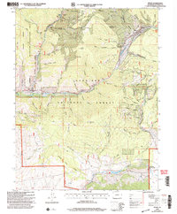
 - 2001 Map of Flat Top, 2004 Print
 2001 Flat Top2004 Print · USGSCovers Gunnison County, including United States, Colorado, and other nearby areas
 - 2001 Map of Bowie, 2004 Print
 2001 Bowie2004 Print · USGSCovers Gunnison County, including Paonia, Bowie, and other nearby areas
 - 2001 Map of Electric Mountain, 2004 Print
 2001 Electric Mountain2004 Print · USGSCovers Gunnison County, including Delta County, United States, and other nearby areas
 - 2001 Map of Cement Mountain, 2004 Print
 2001 Cement Mountain2004 Print · USGSCovers Gunnison County, including United States, Colorado, and other nearby areas
 - 2001 Map of West Elk Peak SW, 2004 Print
 2001 West Elk Peak SW2004 Print · USGSCovers Gunnison County, including United States, Colorado, and other nearby areas
 - 2001 Map of Whitepine, 2004 Print
 2001 Whitepine2004 Print · USGSCovers Gunnison County, including Whitepine, Chaffee County, and other nearby areas
 - 2001 Map of Italian Creek, 2004 Print
 2001 Italian Creek2004 Print · USGSCovers Gunnison County, including United States, Colorado, and other nearby areas
 - 2001 Map of Oh-Be-Joyful, 2004 Print
 2001 Oh-Be-Joyful2004 Print · USGSCovers Gunnison County, including United States, Colorado, and other nearby areas
 - 2001 Map of Fairview Peak, 2004 Print
 2001 Fairview Peak2004 Print · USGSCovers Gunnison County, including United States, Colorado, and other nearby areas
 - 2001 Map of Chair Mountain, 2004 Print
 2001 Chair Mountain2004 Print · USGSCovers Gunnison County, including Pitkin County, United States, and other nearby areas
 - 2001 Map of Matchless Mountain, 2004 Print
 2001 Matchless Mountain2004 Print · USGSCovers Gunnison County, including United States, Colorado, and other nearby areas
 - 2001 Map of Somerset, 2004 Print
 2001 Somerset2004 Print · USGSCovers Gunnison County, including Somerset, Delta County, and other nearby areas
 - 2001 Map of X Lazy F Ranch, 2004 Print
 2001 X Lazy F Ranch2004 Print · USGSCovers Gunnison County, including Montrose County, United States, and other nearby areas
 - 2001 Map of Sapinero, 2004 Print
 2001 Sapinero2004 Print · USGSCovers Gunnison County, including Sapinero, United States, and other nearby areas
 - 2001 Map of Bull Mountain, 2004 Print
 2001 Bull Mountain2004 Print · USGSCovers Gunnison County, including Harry Parker Place, Patterson Place, and other nearby areas
 - 2001 Map of Mount Guero, 2004 Print
 2001 Mount Guero2004 Print · USGSCovers Gunnison County, including Montrose County, United States, and other nearby areas
 - 2001 Map of Pitkin, 2004 Print
 2001 Pitkin2004 Print · USGSCovers Gunnison County, including Pitkin, Ohio, and other nearby areas
 - 2001 Map of Crested Butte, 2004 Print
 2001 Crested Butte2004 Print · USGSCovers Gunnison County, including Crested Butte, Crested Butte South, and other nearby areas
 - 2001 Map of Minnesota Pass, 2004 Print
 2001 Minnesota Pass2004 Print · USGSCovers Gunnison County, including Delta County, United States, and other nearby areas
 - 2001 Map of Curecanti Needle, 2004 Print
 2001 Curecanti Needle2004 Print · USGSCovers Gunnison County, including Montrose County, United States, and other nearby areas
 - 2001 Map of Little Soap Park, 2004 Print
 2001 Little Soap Park2004 Print · USGSCovers Gunnison County, including United States, Colorado, and other nearby areas
 - 2001 Map of Mc Intosh Mountain, 2004 Print
 2001 Mc Intosh Mountain2004 Print · USGSCovers Gunnison County, including United States, Colorado, and other nearby areas
Showing maps 1-25 of 120
Top cities of Gunnison County
- Gunnison historical maps
- Crested Butte historical maps
- Mount Crested Butte historical maps
- Marble historical maps
- Pitkin historical maps
Frequently asked questions
- What are the different types of historical maps available for Gunnison County?
- What is the oldest map of Gunnison County?
- Where can I purchase historical maps of Gunnison County for my home or office?
- Where can I download high-res historical maps of Gunnison County?
- Are there historical topographic maps available for Gunnison County?
- Is there historical aerial imagery available for Gunnison County?
- Where are historical maps of Gunnison County sourced from?