2023 Map of Margaretville
USGS Topo · Published 2023About this map
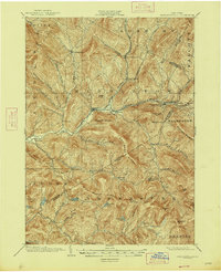
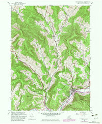
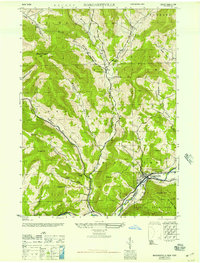
The East Branch Delaware River flows through the southeastern portion of this landscape, supporting the established village of Margaretville and the nearby hamlet of Dunraven. The topography is defined by a series of steep hollows and ridges, including Canada Hollow, Weaver Hollow, and Bragg Hollow, which have historically shaped the local road networks and agricultural patterns. To the north, the settlement of New Kingston sits amidst several smaller valleys, where family-named landmarks like Thompson Hollow and Sanford Hollow persist.
Find a feature on this map
111 named features on this map. Tap any name to fly to it.
Don’t see what you’re looking for? This feature index may not catch every label — zoom into the map to look around manually.
Map Details
Editions of this 2023 Margaretville Map
This is the sole edition of this map. No revisions or reprints were ever made.
Historical Maps of Andes Through Time
5 maps found