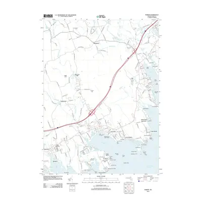
2012 Map of Marion
USGS Topo · Published 2012About this map
Mattapoisett Harbor and the Sippican River estuary define this coastal landscape on the edge of Buzzards Bay. The coastline is dense with local history, featuring the Neds Point Light and the Mattapoisett Town Wharf, alongside established summer colonies and settlements like Antassawamock and Point Connett. Interior regions reveal a transition to former industrial and agricultural sites, including Sturtevant Mill and the clustered cemeteries of Hammond Cem, Barlow Cem, and Cushing Cem. Genealogists may find value in the varied burial grounds and the long-standing Alms House near Harbor Beach. The map also captures the sprawling wetlands and brooks that feed the Mattapoisett River, showing a complex interplay between the developed shoreline at Pico Beach and the inland woods of Tinkhamtown.
Find a feature on this map
199 named features on this map. Tap any name to fly to it.
Don’t see what you’re looking for? This feature index may not catch every label — zoom into the map to look around manually.
Map Details
Editions of this 2012 Marion Map
This is the sole edition of this map. No revisions or reprints were ever made.
Other maps of this area

1885 · New Bedford
USGS Topo · 1:62,500

1885 · Middleboro
USGS Topo · 1:62,500

1886 · Falmouth
USGS Topo · 1:62,500

1886 · Plymouth
USGS Topo · 1:62,500

1888 · New Bedford
USGS Topo · 1:62,500

1888 · Falmouth
USGS Topo · 1:62,500

1888 · Middleboro
USGS Topo · 1:62,500

1889 · Plymouth
USGS Topo · 1:62,500

1893 · Middleboro
USGS Topo · 1:62,500

1893 · Falmouth
USGS Topo · 1:62,500