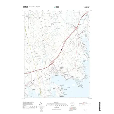
2021 Map of Marion
USGS Topo · Published 2021About this map
Mattapoisett Harbor and Sippican Harbor define the jagged shoreline of this Plymouth County coastal region, where traditional village centers meet a complex network of marshes and coves. The landscape is heavily influenced by the drainage of the Mattapoisett River and Sippican River, which feed into expansive wetlands like Towers Swamp and the Sippican River Marshes. Historic settlement patterns are evident in the concentration of burial grounds such as Center Cem and Old Landing Cem, alongside industrial and social landmarks like Sturtevant Mill and the Alms House. From the beach communities at Antassawamock and Point Connett to the inland groves near Tinkhamtown, the map reveals a community defined by its maritime proximity and the enduring boundaries of its early townships.
Find a feature on this map
204 named features on this map. Tap any name to fly to it.
Don’t see what you’re looking for? This feature index may not catch every label — zoom into the map to look around manually.
Map Details
Editions of this 2021 Marion Map
This is the sole edition of this map. No revisions or reprints were ever made.
Other maps of this area

1885 · New Bedford
USGS Topo · 1:62,500

1885 · Middleboro
USGS Topo · 1:62,500

1886 · Falmouth
USGS Topo · 1:62,500

1886 · Plymouth
USGS Topo · 1:62,500

1888 · New Bedford
USGS Topo · 1:62,500

1888 · Falmouth
USGS Topo · 1:62,500

1888 · Middleboro
USGS Topo · 1:62,500

1889 · Plymouth
USGS Topo · 1:62,500

1893 · Middleboro
USGS Topo · 1:62,500

1893 · Falmouth
USGS Topo · 1:62,500