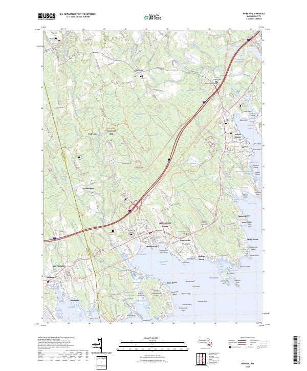
2024 Map of Marion
USGS Topo · Published 2024About this map
The coastal village of Mattapoisett and the historic harbor at Marion define the geography of this modern coastal survey. The map details a landscape where traditional New England settlements meet the Buzzards Bay shoreline, featuring dense networks of marshes like the Mattapoisett River Marshes and Sippican Harbor Marshes. Genealogists will find a concentration of burial sites, including the Old Landing Cem and the Friends' Burial Ground, which speak to the area's Quaker heritage. Inland, the terrain is shaped by extensive wetlands such as Haskell Swamp and Towers Swamp, alongside remnants of early industry at Sturtevant Mill. Points of local interest like the Alms House near Harbor Beach and the Mattapoisett Town Beach illustrate the evolution of these towns from maritime and agricultural hubs to residential and seasonal communities.
Find a feature on this map
226 named features on this map. Tap any name to fly to it.
Don’t see what you’re looking for? This feature index may not catch every label — zoom into the map to look around manually.
Map Details
Editions of this 2024 Marion Map
This is the sole edition of this map. No revisions or reprints were ever made.
Other maps of this area

1885 · New Bedford
USGS Topo · 1:62,500

1885 · Middleboro
USGS Topo · 1:62,500

1886 · Falmouth
USGS Topo · 1:62,500

1886 · Plymouth
USGS Topo · 1:62,500

1888 · New Bedford
USGS Topo · 1:62,500

1888 · Falmouth
USGS Topo · 1:62,500

1888 · Middleboro
USGS Topo · 1:62,500

1889 · Plymouth
USGS Topo · 1:62,500

1893 · Middleboro
USGS Topo · 1:62,500

1893 · Falmouth
USGS Topo · 1:62,500