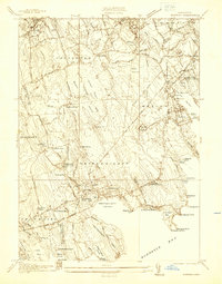
1936 Map of Marion
USGS Topo · Published 1936About this map
Buzzards Bay defines the southern edge of this coastal landscape, where the seafaring and agricultural traditions of Plymouth and Bristol counties meet. In the 1930s, the shoreline from Crescent Beach to Angelica Point is dotted with summer settlements and landmarks like Neds Point Light. Inland, the economy is driven by the cranberry industry, visible in extensive operations such as the Mattapoisett Cranberry Co Bog and Sippican Bog.
Find a feature on this map
91 named features on this map. Tap any name to fly to it.
Don’t see what you’re looking for? This feature index may not catch every label — zoom into the map to look around manually.
Map Details
Editions of this 1936 Marion Map
This is the sole edition of this map. No revisions or reprints were ever made.
Other maps of this area

1885 · New Bedford
USGS Topo · 1:62,500

1885 · Middleboro
USGS Topo · 1:62,500

1886 · Falmouth
USGS Topo · 1:62,500

1886 · Plymouth
USGS Topo · 1:62,500

1888 · New Bedford
USGS Topo · 1:62,500

1888 · Falmouth
USGS Topo · 1:62,500

1888 · Middleboro
USGS Topo · 1:62,500

1889 · Plymouth
USGS Topo · 1:62,500

1893 · Middleboro
USGS Topo · 1:62,500

1893 · Falmouth
USGS Topo · 1:62,500