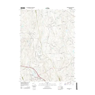
2015 Map of Marlborough
USGS Topo · Published 2015About this map
Lake Terramuggus and the surrounding hills of Marlborough anchor this central Connecticut landscape, where the town centers of Gilead and Four Corners serve as historic hubs. The terrain is marked by numerous family-named peaks such as Mannantuck Hill, John Tom Hill, and Birch Mtn, reflecting a long history of local landownership and rural settlement. Waterways like the Blackledge River and Dickinson Cr flow through the valleys, while several small cemeteries, including Old Marlborough Cem and Gilead Cem, offer touchstones for genealogical research. The map captures a mix of residential growth and preserved wooded areas, with several reservoirs and ponds like Diamond Lake and Buckingham Reservoir scattered throughout the highlands. The convergence of Hartford, Tolland, and Middlesex county lines near the southern edge emphasizes the strategic location of these uplands between regional centers.
Find a feature on this map
165 named features on this map. Tap any name to fly to it.
Don’t see what you’re looking for? This feature index may not catch every label — zoom into the map to look around manually.
Map Details
Editions of this 2015 Marlborough Map
This is the sole edition of this map. No revisions or reprints were ever made.
Other maps of this area

1892 · Hartford
USGS Topo · 1:62,500

1892 · Tolland
USGS Topo · 1:62,500

1892 · Gilead
USGS Topo · 1:62,500

1893 · Middletown
USGS Topo · 1:62,500

1906 · Farmington
USGS Topo · 1:125,000

1921 · Tolland
USGS Topo · 1:62,500

1928 · Glastonbury
USGS Topo · 1:24,000

1928 · Manchester
USGS Topo · 1:24,000

1944 · Manchester
USGS Topo · 1:31,680

1944 · Marlboro
USGS Topo · 1:31,680