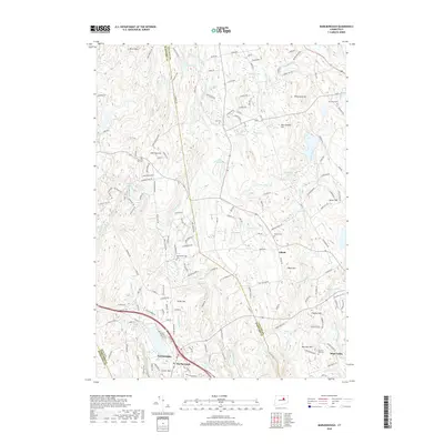
2018 Map of Marlborough
USGS Topo · Published 2018About this map
Marlborough and the surrounding highlands of the Hartford and Tolland borderlands are defined by a complex network of brooks and ridges. The village of Gilead sits centrally, anchored by the Gilead Cem, while the landscape is dotted with other family and community burial grounds such as Gay Cem and John Tom Hill Cem. This area, characteristic of eastern Connecticut's uplands, features several prominent summits including Birch Mtn, New Boston Hill, and Burrows Hill. Waterways like the Blackledge River and Dickinson Creek wind through the terrain, while larger basins like Diamond Lake and Lake Terramuggus provide significant local landmarks. The distribution of small settlements like Terramuggus and Hope Valley reflects the historical development patterns of this region, where community centers evolved around specific hills and water resources.
Find a feature on this map
167 named features on this map. Tap any name to fly to it.
Don’t see what you’re looking for? This feature index may not catch every label — zoom into the map to look around manually.
Map Details
Editions of this 2018 Marlborough Map
This is the sole edition of this map. No revisions or reprints were ever made.
Other maps of this area

1892 · Hartford
USGS Topo · 1:62,500

1892 · Tolland
USGS Topo · 1:62,500

1892 · Gilead
USGS Topo · 1:62,500

1893 · Middletown
USGS Topo · 1:62,500

1906 · Farmington
USGS Topo · 1:125,000

1921 · Tolland
USGS Topo · 1:62,500

1928 · Glastonbury
USGS Topo · 1:24,000

1928 · Manchester
USGS Topo · 1:24,000

1944 · Manchester
USGS Topo · 1:31,680

1944 · Marlboro
USGS Topo · 1:31,680