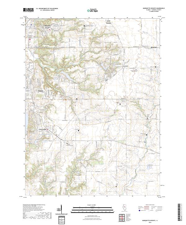
2024 Map of Marquette Heights
USGS Topo · Published 2024About this map
Marquette Heights and the eastern outskirts of Pekin anchor this survey of Tazewell County, where residential development meets the drainage systems of Lick Creek and Lost Creek. The landscape is notably dense with small community landmarks and historical burial grounds, ranging from the Groveland Evangelical Mennonite Cem to the Tazewell County Farm Cem. Between the established settlements of Groveland and Morton, the map captures a pattern of suburban expansion characterized by private water features like Lake of the Whispering Oaks and Bessler Lakes.
Find a feature on this map
53 named features on this map. Tap any name to fly to it.
Don’t see what you’re looking for? This feature index may not catch every label — zoom into the map to look around manually.
Map Details
Editions of this 2024 Marquette Heights Map
This is the sole edition of this map. No revisions or reprints were ever made.
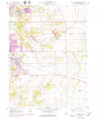
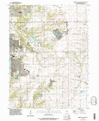
Historical Maps of Tremont Through Time
3 maps found