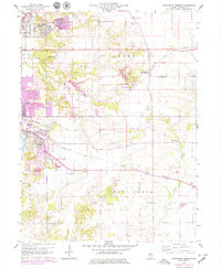
1960 Map of Marquette Heights
USGS Topo · Published 1979About this map
Marquette Heights and the surrounding townships of Groveland and Elm Grove show a landscape in the midst of suburban expansion during the mid-to-late 20th century. While the city of Pekin anchors the western edge, the map documents the growth of residential subdivisions like Pekin Heights and Towne Oaks alongside established agricultural lands. This period of development is reflected in the purple photorevised overlays, which track new infrastructure such as the Landing Strip and expanded street grids near North Pekin.
Find a feature on this map
49 named features on this map. Tap any name to fly to it.
Don’t see what you’re looking for? This feature index may not catch every label — zoom into the map to look around manually.
Map Details
Editions of this 1960 Marquette Heights Map
3 editions found

Other maps of this area

1905 · Peoria
USGS Topo · 1:62,500

1927 · Peoria
USGS Topo · 1:62,500

1928 · Mackinaw
USGS Topo · 1:62,500

1932 · Mackinaw
USGS Topo · 1:62,500

1942 · Delavan
USGS Topo · 1:62,500

1949 · Peoria East
USGS Topo · 1:24,000

1949 · Peoria West
USGS Topo · 1:24,000

1950 · Peoria West
USGS Topo · 1:24,000
1950 · Peoria East
USGS Topo · 1:24,000

1951 · Minier
USGS Topo · 1:62,500