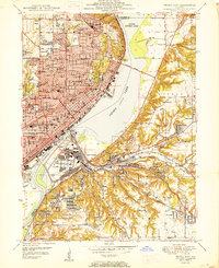
1950 Map of Peoria East
USGS Topo · Published 1950About this map
The Illinois River serves as the industrial and geographical heart of this mid-century portrait of Peoria and its neighboring communities. The map captures a densely developed urban grid characterized by its high concentration of local institutions, including Bradley University and specialized secondary schools like Manual Training High Sch and Woodruff High Sch. On the eastern bank, the topography of Fondulac and Groveland rises sharply from the floodplain, creating a distinct physical separation between the river-level industries of East Peoria and the residential developments of Sunnyland and Cloverdale.
Find a feature on this map
92 named features on this map. Tap any name to fly to it.
Don’t see what you’re looking for? This feature index may not catch every label — zoom into the map to look around manually.
Map Details
Editions of this 1950 Peoria East Map
This is the sole edition of this map. No revisions or reprints were ever made.
Other maps of this area

1893 · Metamora
USGS Topo · 1:62,500

1893 · Dunlap
USGS Topo · 1:62,500

1898 · Dunlap
USGS Topo · 1:62,500

1905 · Peoria
USGS Topo · 1:62,500

1927 · Peoria
USGS Topo · 1:62,500

1928 · Mackinaw
USGS Topo · 1:62,500

1932 · Mackinaw
USGS Topo · 1:62,500

1932 · Dunlap
USGS Topo · 1:62,500

1933 · Dunlap
USGS Topo · 1:62,500

1937 · Metamora
USGS Topo · 1:62,500