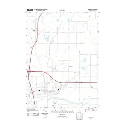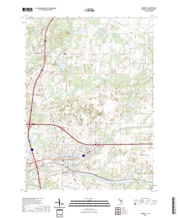
1980 Map of Marshall
USGS Topo · Published 1980About this map
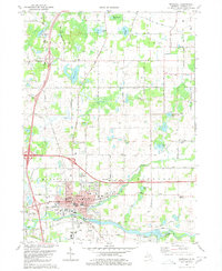
The Kalamazoo River and Conrail line define the southern landscape of this 1980 survey, where the city of Marshall serves as a regional hub for education and commerce. The map records several institutional landmarks including the Fairground, Marshall Airport, and multiple local schools such as Shearman Sch and Hughes Sch. Surrounding the developed center, the terrain is dotted with small kettle lakes like Pork-Barrel Lake and Lake of the Woods, interspersed with family-named burial grounds including Porter Cem and Townsend Cem.
Find a feature on this map
58 named features on this map. Tap any name to fly to it.
Don’t see what you’re looking for? This feature index may not catch every label — zoom into the map to look around manually.
Map Details
Editions of this 1980 Marshall Map
This is the sole edition of this map. No revisions or reprints were ever made.
Historical Maps of Marshall Through Time
9 maps found