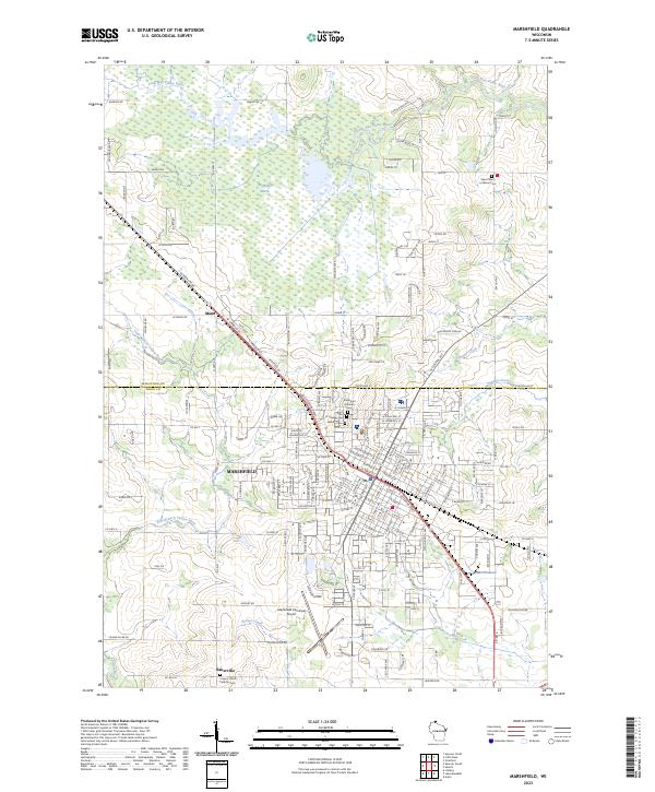
2023 Map of Marshfield
USGS Topo · Published 2023About this map
Marshfield serves as the focal point of this Wood County landscape, where the urban grid meets the extensive wetlands of the McMillan Marsh to the north. This modern survey illustrates the proximity of the Little Eau Pleine River to the city's northern edges and the network of local waterways including McMillan Creek and the East Branch Yellow River. For those researching local family history, the map provides precise locations for several regional burial grounds, including Hillside Cem, Gates of Heaven Cem, and Saint Peter's Lutheran Cem near the Marathon County border. To the southwest, the small settlement of Bakerville is anchored by the Corpus Christi Catholic Cem, while the Marshfield Municipal Airport and Wildwood Park signify the city's modern infrastructure and community spaces.
Find a feature on this map
161 named features on this map. Tap any name to fly to it.
Don’t see what you’re looking for? This feature index may not catch every label — zoom into the map to look around manually.
Map Details
Editions of this 2023 Marshfield Map
This is the sole edition of this map. No revisions or reprints were ever made.
Historical Maps of Cameron Through Time
4 maps found