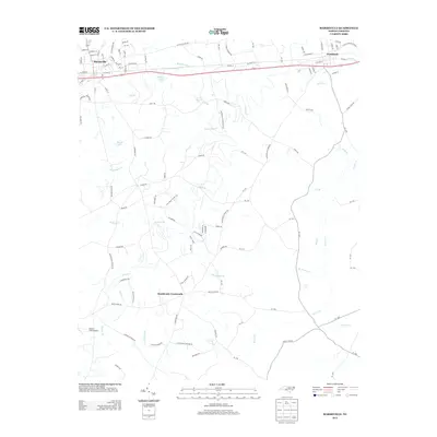
2013 Map of Marshville
USGS Topo · Published 2013About this map
Marshville and Peachland anchor the northern corridor of this Union County landscape, bisected by the primary east-west route of Highway 74. The area transitions from the street grids of these established towns into a network of rural routes and family-named water features. Notable among these are Stegall Lake and Marsh Lake, which feed into a complex system of creeks including Beaverdam Cr and Lanes Cr. To the south, Sturdivants Crossroads serves as a localized hub for the surrounding farmland.
Find a feature on this map
122 named features on this map. Tap any name to fly to it.
Don’t see what you’re looking for? This feature index may not catch every label — zoom into the map to look around manually.
Map Details
Editions of this 2013 Marshville Map
This is the sole edition of this map. No revisions or reprints were ever made.
Other maps of this area

1941 · Spartanburg
USGS Topo · 1:250,000

1953 · Spartanburg
USGS Topo · 1:250,000

1953 · Charlotte
USGS Topo · 1:250,000

1954 · Charlotte
USGS Topo · 1:250,000

1960 · Charlotte
USGS Topo · 1:250,000

1960 · Spartanburg
USGS Topo · 1:250,000

1962 · Charlotte
USGS Topo · 1:250,000

1963 · Spartanburg
USGS Topo · 1:250,000

1964 · Spartanburg
USGS Topo · 1:250,000
1970 · Watson
USGS Topo · 1:24,000