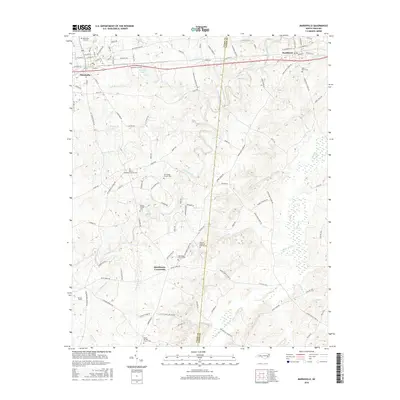
2016 Map of Marshville
USGS Topo · Published 2016About this map
Marshville and Peachland anchor the northern landscape of this North Carolina survey, connected by the busy corridor of Marshville Blvd. The terrain is defined by a dense network of minor waterways, including Lick Br and Beaverdam Cr, which carve through the land south of the primary settlements. This area is notably rich in genealogical sites, featuring several small community cemeteries such as the Gilboa Methodist Church Cem and the Flint Ridge Church Cem. Further south, the rural character deepens at Sturdivants Crossroads, where family-named landmarks like William Malachai Rushing Cem reflect long-standing local ties. The presence of Stegall Lake and Marsh Lake among the many creek branches suggests a landscape where water management and agriculture have shaped the road patterns and settlement locations over generations.
Find a feature on this map
116 named features on this map. Tap any name to fly to it.
Don’t see what you’re looking for? This feature index may not catch every label — zoom into the map to look around manually.
Map Details
Editions of this 2016 Marshville Map
This is the sole edition of this map. No revisions or reprints were ever made.
Other maps of this area

1941 · Spartanburg
USGS Topo · 1:250,000

1953 · Spartanburg
USGS Topo · 1:250,000

1953 · Charlotte
USGS Topo · 1:250,000

1954 · Charlotte
USGS Topo · 1:250,000

1960 · Charlotte
USGS Topo · 1:250,000

1960 · Spartanburg
USGS Topo · 1:250,000

1962 · Charlotte
USGS Topo · 1:250,000

1963 · Spartanburg
USGS Topo · 1:250,000

1964 · Spartanburg
USGS Topo · 1:250,000
1970 · Watson
USGS Topo · 1:24,000