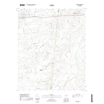
2019 Map of Marshville
USGS Topo · Published 2019About this map
Marshville and Peachland anchor the northern corridor of this landscape, situated along the shared border of Union and Anson counties. The terrain is defined by a dense network of tributaries including Lanes Creek, Beaverdam Cr, and Brown Cr, which carve through the rural countryside. A significant concentration of historic burial grounds and community focal points are found here, such as the Gilboa Methodist Church Cem and the William Malachai Rushing Cem.
Find a feature on this map
120 named features on this map. Tap any name to fly to it.
Don’t see what you’re looking for? This feature index may not catch every label — zoom into the map to look around manually.
Map Details
Editions of this 2019 Marshville Map
This is the sole edition of this map. No revisions or reprints were ever made.
Other maps of this area

1941 · Spartanburg
USGS Topo · 1:250,000

1953 · Spartanburg
USGS Topo · 1:250,000

1953 · Charlotte
USGS Topo · 1:250,000

1954 · Charlotte
USGS Topo · 1:250,000

1960 · Charlotte
USGS Topo · 1:250,000

1960 · Spartanburg
USGS Topo · 1:250,000

1962 · Charlotte
USGS Topo · 1:250,000

1963 · Spartanburg
USGS Topo · 1:250,000

1964 · Spartanburg
USGS Topo · 1:250,000
1970 · Watson
USGS Topo · 1:24,000