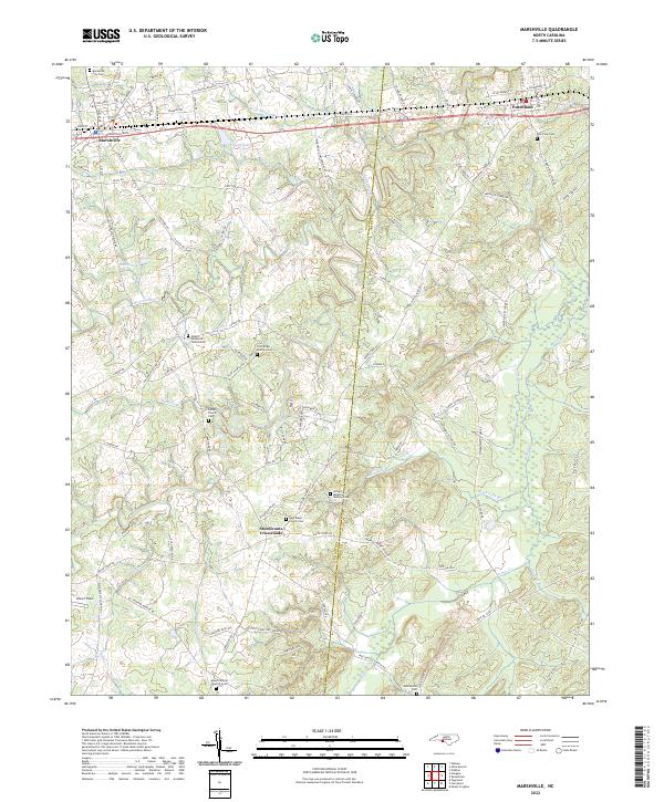
2022 Map of Marshville
USGS Topo · Published 2022About this map
Marshville and Peachland anchor the northern reaches of this Union and Anson County borderland, connected by the parallel corridors of Marshville Blvd and the historic Old Hwy-74. The landscape is defined by the winding course of Lanes Creek and its many tributaries, such as Lick Br and Wide Mouth Br, which carve through the terrain south toward Sturdivants Crossroads.
Find a feature on this map
108 named features on this map. Tap any name to fly to it.
Don’t see what you’re looking for? This feature index may not catch every label — zoom into the map to look around manually.
Map Details
Editions of this 2022 Marshville Map
This is the sole edition of this map. No revisions or reprints were ever made.
Other maps of this area

1941 · Spartanburg
USGS Topo · 1:250,000

1953 · Spartanburg
USGS Topo · 1:250,000

1953 · Charlotte
USGS Topo · 1:250,000

1954 · Charlotte
USGS Topo · 1:250,000

1960 · Charlotte
USGS Topo · 1:250,000

1960 · Spartanburg
USGS Topo · 1:250,000

1962 · Charlotte
USGS Topo · 1:250,000

1963 · Spartanburg
USGS Topo · 1:250,000

1964 · Spartanburg
USGS Topo · 1:250,000
1970 · Watson
USGS Topo · 1:24,000