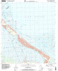
1998 Map of Martello Castle
USGS Topo · Published 2001About this map
Martello Castle stands as a landmark amidst the intricate marshlands and wetlands where Orleans Parish and St. Bernard Parish meet. This late 20th-century landscape is defined by the massive engineering of the Mississippi River - Gulf Outlet Canal, which cuts a wide path through the coastal terrain. The map documents an environment of transition, where natural waterways like Bienvenue Bayou and Shell Beach Bayou are intersected by industrial features, including extensive Spoil Areas and various Drill Holes. The network of interior channels, such as Dupre Bayou and Terre-Beau Bayou, highlights the complex hydrology of the region leading toward Lake Borgne. This survey captures the coast during a period of heavy maritime infrastructure development, showing the proximity of the Violet Canal to the shifting marsh islands and coastal bayous.
Find a feature on this map
20 named features on this map. Tap any name to fly to it.
Don’t see what you’re looking for? This feature index may not catch every label — zoom into the map to look around manually.
Map Details
Editions of this 1998 Martello Castle Map
This is the sole edition of this map. No revisions or reprints were ever made.
Other maps of this area

1892 · Chef Menteur
USGS Topo · 1:62,500

1892 · St. Bernard
USGS Topo · 1:62,500

1893 · Rigolets
USGS Topo · 1:62,500

1893 · Shell Beach
USGS Topo · 1:62,500

1935 · Delacroix
USGS Topo · 1:31,680

1936 · Chef Menteur
USGS Topo · 1:62,500

1936 · Rigolets
USGS Topo · 1:62,500

1937 · Chef Menteur
USGS Topo · 1:31,680

1938 · Little Woods
USGS Topo · 1:31,680

1939 · Shell Beach
USGS Topo · 1:62,500