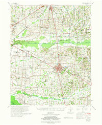
1972 Map of Martin
USGS Topo · Published 1972About this map
Martin serves as the central hub of this West Tennessee landscape, where the agricultural plains are bisected by the North Fork Obion River and its numerous tributaries. The map reveals a high density of rural social infrastructure, from the Stella Ruth Community Center to localized education points like Chestnut Glade Sch and Vincent Grove Sch. The presence of the Morris Slave Cem near the northern boundary provides a significant genealogical touchpoint for local history researchers.
Find a feature on this map
63 named features on this map. Tap any name to fly to it.
Don’t see what you’re looking for? This feature index may not catch every label — zoom into the map to look around manually.
Map Details
Editions of this 1972 Martin Map
This is the sole edition of this map. No revisions or reprints were ever made.
Other maps of this area

1939 · Hickman
USGS Topo · 1:62,500

1950 · Martin
USGS Topo · 1:24,000

1950 · Rives
USGS Topo · 1:24,000

1951 · Rives
USGS Topo · 1:24,000

1951 · Cayce
USGS Topo · 1:24,000

1952 · Crutchfield
USGS Topo · 1:24,000

1952 · Dresden
USGS Topo · 1:24,000

1952 · Cuba
USGS Topo · 1:24,000

1952 · Water Valley
USGS Topo · 1:24,000

1952 · Mayfield
USGS Topo · 1:62,500