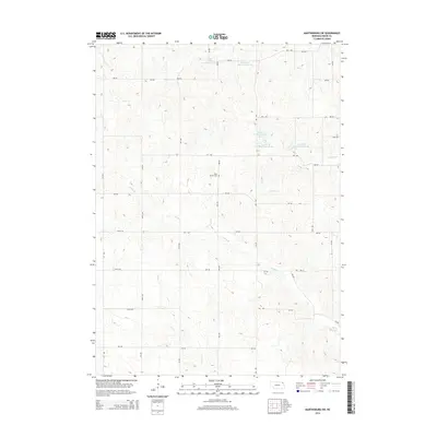
2014 Map of Martinsburg SW
USGS Topo · Published 2014About this map
Daily Branch Cem rests within a landscape of rolling agriculture and complex water management systems in this section of Dixon County. The terrain is defined by the branching tributaries of Aowa Cr and Daily Br, where a network of modern reservoirs including Aowa Cr Reservoir 62-5A and Powder Creek Reservoir 32-9 has been established to manage drainage and runoff. These features illustrate the intersection of local geography and hydraulic engineering in the Great Plains. The map also records a rectilinear grid of rural routes such as 883 RD and 581 Ave, which facilitate movement between the homesteads and fields. This 2014 survey by the U.S. Geological Survey provides an essential record for those studying land use and genealogy in the Martinsburg SW vicinity.
Find a feature on this map
33 named features on this map. Tap any name to fly to it.
Don’t see what you’re looking for? This feature index may not catch every label — zoom into the map to look around manually.
Map Details
Editions of this 2014 Martinsburg SW Map
This is the sole edition of this map. No revisions or reprints were ever made.
Other maps of this area

1898 · Elk Point
USGS Topo · 1:125,000

1901 · Elk Point
USGS Topo · 1:125,000

1907 · Elk Point
USGS Topo · 1:125,000

1955 · Sioux City
USGS Topo · 1:250,000

1958 · Sioux City
USGS Topo · 1:250,000

1959 · Sioux City
USGS Topo · 1:250,000

1964 · Martinsburg SW
USGS Topo · 1:24,000

1964 · Burbank
USGS Topo · 1:24,000

1964 · Maskell
USGS Topo · 1:24,000
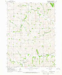
1964 · Martinsburg
USGS Topo · 1:24,000
Featured Places
- Wakefield Township, NE
- Clark Township, NE
- Daily Township, NE
- Silvercreek Township, NE
- Newcastle Township, NE