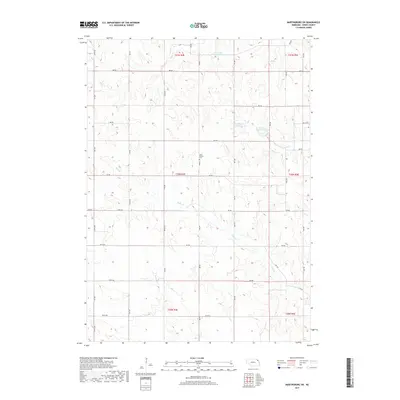
2017 Map of Martinsburg SW
USGS Topo · Published 2017About this map
The rolling agricultural landscape of northern Nebraska is defined by the complex drainage systems of the Missouri River watershed, as seen in this 2017 survey. The Daily Branch Cem stands as a quiet marker of early settlement history amidst a grid of section-line roads such as 880 Rd and 580 Ave. The map highlights a modern approach to water management through a series of engineered catchments, including Aowa Cr Reservoir 69-A, Powder Cr Reservoir 32-13, and Aowa Cr Reservoir 32-4A. These reservoirs, distributed along the branching headwaters of Aowa Cr and Powder Cr, illustrate the region's efforts to control erosion and manage runoff in an area traditionally dominated by farmsteads. Smaller tributaries like Daily Br and Jordan Cr carve through the terrain, indicating the natural hydrology that shaped the original homesteading patterns.
Find a feature on this map
41 named features on this map. Tap any name to fly to it.
Don’t see what you’re looking for? This feature index may not catch every label — zoom into the map to look around manually.
Map Details
Editions of this 2017 Martinsburg SW Map
This is the sole edition of this map. No revisions or reprints were ever made.
Other maps of this area

1898 · Elk Point
USGS Topo · 1:125,000

1901 · Elk Point
USGS Topo · 1:125,000

1907 · Elk Point
USGS Topo · 1:125,000

1955 · Sioux City
USGS Topo · 1:250,000

1958 · Sioux City
USGS Topo · 1:250,000

1959 · Sioux City
USGS Topo · 1:250,000

1964 · Martinsburg SW
USGS Topo · 1:24,000

1964 · Burbank
USGS Topo · 1:24,000

1964 · Maskell
USGS Topo · 1:24,000
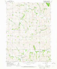
1964 · Martinsburg
USGS Topo · 1:24,000
Featured Places
- Wakefield Township, NE
- Clark Township, NE
- Daily Township, NE
- Silvercreek Township, NE
- Newcastle Township, NE