
1964 Map of Martinsburg SW
USGS Topo · Published 1965About this map
Rural township life in Dixon County is meticulously detailed in this mid-1960s survey, where the landscape is defined by the drainage of Daily Branch and Powder Creek. The map reveals a high density of community landmarks that suggest a once-vibrant network of neighborhood school districts, including Lone Tree Sch, Longview Sch, and School No 20. Civil administration centers on the Townhall located within the Daily township boundary, while religious and family history is preserved at sites like St Patricks Ch and its associated St Patricks Cem. This record is particularly valuable for genealogists, as it captures the specific placement of rural institutions like Plainview Sch and O'Hara Sch before the consolidation of many such rural districts. The intricate network of field lines and local roads provides a clear picture of the mid-century agricultural footprint across the Clark and Galena townships.
Find a feature on this map
18 named features on this map. Tap any name to fly to it.
Don’t see what you’re looking for? This feature index may not catch every label — zoom into the map to look around manually.
Map Details
Editions of this 1964 Martinsburg SW Map
This is the sole edition of this map. No revisions or reprints were ever made.
Other maps of this area

1898 · Elk Point
USGS Topo · 1:125,000

1901 · Elk Point
USGS Topo · 1:125,000

1907 · Elk Point
USGS Topo · 1:125,000

1955 · Sioux City
USGS Topo · 1:250,000

1958 · Sioux City
USGS Topo · 1:250,000

1959 · Sioux City
USGS Topo · 1:250,000

1964 · Burbank
USGS Topo · 1:24,000

1964 · Maskell
USGS Topo · 1:24,000
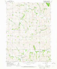
1964 · Martinsburg
USGS Topo · 1:24,000
1967 · Allen
USGS Topo · 1:24,000
Featured Places
- Wakefield Township, NE
- Newcastle Township, NE
- Silvercreek Township, NE
- Daily Township, NE
- Hooker Township, NE