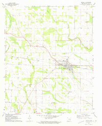
1971 Map of Marvell
USGS Topo · Published 1973About this map
The Marvell community serves as the central hub of this Delta landscape, situated along the Missouri Pacific railroad. The town is marked by its educational and civic institutions, including the High School, Marvell Academy, and a local Fairground. Surrounding the town, a network of rural churches and cemeteries provides a clear picture of the area's genealogical history. Significant family and community landmarks such as Mt Mariah Cemetery, Schaffhauser Cemetery, and Lone Valley Cemetery are distributed across the countryside. The geography is defined by the winding paths of Little Cypress Creek, Crooked Creek, and Coffee Creek, which intersect the agricultural grid. This survey also records a local Landing Strip and a Fish Farm, reflecting the specialized land use and infrastructure of Phillips County during the early 1970s.
Find a feature on this map
36 named features on this map. Tap any name to fly to it.
Don’t see what you’re looking for? This feature index may not catch every label — zoom into the map to look around manually.
Map Details
Editions of this 1971 Marvell Map
This is the sole edition of this map. No revisions or reprints were ever made.
Other maps of this area

1939 · Modoc
USGS Topo · 1:62,500

1939 · Indian Bay
USGS Topo · 1:62,500

1940 · Marvell
USGS Topo · 1:62,500

1940 · Holly Grove
USGS Topo · 1:62,500

1948 · Helena
USGS Topo · 1:250,000

1948 · Modoc
USGS Topo · 1:62,500

1950 · Helena
USGS Topo · 1:250,000

1954 · Indian Bay
USGS Topo · 1:62,500

1955 · Helena
USGS Topo · 1:250,000

1956 · Marvell
USGS Topo · 1:62,500