2025 Map of Mary Esther
USGS Topo · Published 2025About this map
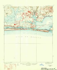
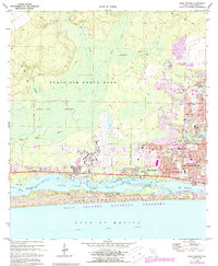
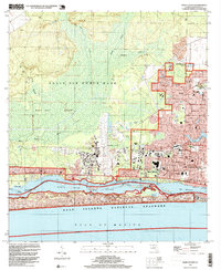
The coastal landscapes and military corridors of Okaloosa County are defined by the presence of Hurlburt Field and the sprawling Eglin Air Force Base. Residential growth in Mary Esther, Wright, and Fort Walton Beach is tightly integrated with these facilities, separated from the Gulf of Mexico by the narrow waters of Santa Rosa Sound. Along the shoreline, Gulf Islands National Seashore preserves the coastal environment of Santa Rosa Island, which is bisected by The Narrows. For genealogists and local historians, the map identifies significant burial sites including the Jesse Rogers Memorial Cem, Beal Memorial Cem, and the historic Eglin AFB Burial Plot Number 2. The map also details the complex water network of Kohler Bayou and Cinco Bayou that provides access to the Intracoastal Waterway.
Find a feature on this map
161 named features on this map. Tap any name to fly to it.
Don’t see what you’re looking for? This feature index may not catch every label — zoom into the map to look around manually.
Map Details
Editions of this 2025 Mary Esther Map
This is the sole edition of this map. No revisions or reprints were ever made.
Historical Maps of Okaloosa County Through Time
4 maps found