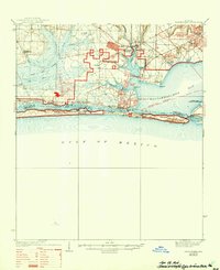
1938 Map of Mary Esther
USGS Topo · Published 1944About this map
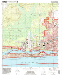
Eglin Air Force Base dominates the landscape of the Florida Panhandle in this mid-century survey, illustrating a critical era of military expansion along the Gulf Coast. The map reveals a transition from coastal fishing and timber communities to a significant defense hub, featuring the Valparaiso Landing Field and Eglin Hulbert Airdrome. Along the barrier sands, the Santa Rosa Island National Monument stretches between the Gulf of Mexico and Santa Rosa Sound, while the shoreline is dotted with development from Fort Walton to Mary Esther. Inland, forestry and fire prevention are marked by the Pinchot Lookout Tower 63 and Camp Pinchot Ranger Sta, reflecting the importance of the pine forests that precede the modern suburban sprawl of Shalimar and Wright. The path of the Intercoastal Waterway through Choctawhatchee Bay highlights the region's enduring maritime commerce.
Find a feature on this map
52 named features on this map. Tap any name to fly to it.
Don’t see what you’re looking for? This feature index may not catch every label — zoom into the map to look around manually.
Map Details
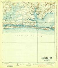
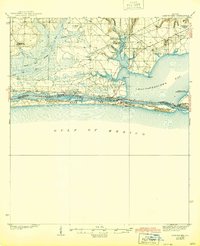
Editions of this 1938 Mary Esther Map
4 editions found

Historical Maps of Fort Walton Beach Through Time
9 maps found
1938 Mary Esther
Okaloosa County, FL
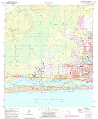
1970 Mary Esther
Okaloosa County, FL
1994 Mary Esther
Okaloosa County, FL

2012 Mary Esther
Okaloosa County, FL

2015 Mary Esther
Okaloosa County, FL

2018 Mary Esther
Okaloosa County, FL

2021 Mary Esther
Okaloosa County, FL

2024 Mary Esther
Okaloosa County, FL

2025 Mary Esther
Okaloosa County, FL