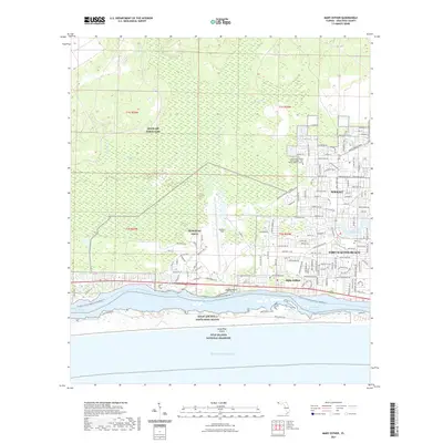
2021 Map of Mary Esther
USGS Topo · Published 2021About this map
Eglin Air Force Base and Hurlburt Field dominate the northern landscape of this coastal Florida corridor, reflecting the deep-seated military character of the Emerald Coast. The developed urban areas of Fort Walton Beach, Wright, and Mary Esther cluster along the northern banks of the Santa Rosa Sound, where residential street grids give way to the Intracoastal Waterway. To the south, the protected terrain of Santa Rosa Island and the Gulf Islands National Seashore provide a stark, undeveloped contrast to the mainland's dense infrastructure. This 2021 update also details the ecological transition from the East Bay Swamp to several coastal tributaries, including Cinco Bayou and Kohler Bayou. Notable local landmarks range from the North-West Florida State College to the Beal Cem, illustrating the mix of modern educational facilities and long-standing community sites.
Find a feature on this map
90 named features on this map. Tap any name to fly to it.
Don’t see what you’re looking for? This feature index may not catch every label — zoom into the map to look around manually.
Map Details
Editions of this 2021 Mary Esther Map
This is the sole edition of this map. No revisions or reprints were ever made.
Other maps of this area

1921 · Holley
USGS Topo · 1:62,500

1934 · Holt
USGS Topo · 1:48,000

1934 · Harold
USGS Topo · 1:62,500

1936 · Holley
USGS Topo · 1:48,000

1937 · Holt
USGS Topo · 1:62,500

1937 · Harold
USGS Topo · 1:62,500

1938 · Mary Esther
USGS Topo · 1:62,500

1938 · Holley
USGS Topo · 1:62,500

1938 · Harold
USGS Topo · 1:62,500

1956 · Fort Walton Beach
USGS Topo · 1:62,500