
1938 Map of Mary Esther
USGS Topo · Published 1938About this map
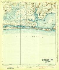
Choctawhatchee National Forest dominates the northern reaches of this coastal landscape, protecting a vast expanse of swamp and pine woods before the onset of modern development. To the south, the barrier of Santa Rosa Island separates the Gulf of Mexico from the intricate waterways of Santa Rosa Sound and Choctawhatchee Bay. This 1930s survey captures the area as it began to transition from isolated fishing and timber communities into a strategic coastal hub. Small settlements like Mary Esther, Fort Walton, and Destin are mapped alongside early aviation infrastructure at the Valparaiso Landing Field. The map also details the administrative presence in the forest, featuring the Pinchot Lookout Tower and the Camp Pinchot Ranger Sta, providing a record of federal land management and early fire protection systems in the Florida Panhandle.
Find a feature on this map
31 named features on this map. Tap any name to fly to it.
Don’t see what you’re looking for? This feature index may not catch every label — zoom into the map to look around manually.
Map Details
Editions of this 1938 Mary Esther Map
4 editions found
Other maps of this area

1921 · Holley
USGS Topo · 1:62,500

1934 · Holt
USGS Topo · 1:48,000

1934 · Harold
USGS Topo · 1:62,500

1934 · Niceville
USGS Topo · 1:48,000

1935 · Villa Tasso
USGS Topo · 1:48,000

1936 · Niceville
USGS Topo · 1:62,500

1936 · Holley
USGS Topo · 1:48,000

1937 · Holt
USGS Topo · 1:62,500

1937 · Harold
USGS Topo · 1:62,500

1938 · Villa Tasso
USGS Topo · 1:62,500